

Going to Moab

In my last post I spoke of the “scenic route” to Moab, Utah: State Route 128 which follows the Colorado River from the historic Dewey Bridge, thirty-some miles out of town, all the way to town. I left you there at Fisher Towers, on one end of “Professor Valley”. My next stop was Castle Valley on the other end of “Professor Valley.”
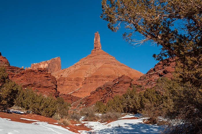
Castle Valley is up Castle Creek, which crosses SR 128 about 17 miles upriver of Moab, and is named for this feature:
A side road from Hwy 128 takes you into the little town.
Now, this rock is kind of famous. John Ford made a number of Westerns, mostly starring John Wayne, at a dude ranch down at the mouth of Castle Creek. And Ford was so fascinated by this rock that he supposedly found a way to include it in every movie that he made here. So, if it looks familiar, you’ve probably seen it in a movie.
Chevrolet made a couple of TV commercials back in the Sixties where they put a car up on top of it! The model who sat in the car while a helicopter filmed her, was so frightened that it is claimed they had to hide a mechanic in the car with her to hold her and keep her calm.
It is made of Wingate sandstone. The coarser red rock in the foreground is the Moenkopi Formation.
The monolith behind this pinnacle is also interesting. At the far end of it are pillars that look like…
a priest and some nuns.
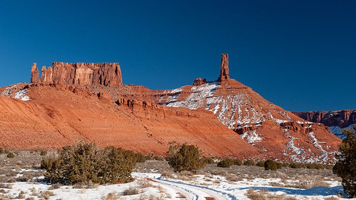
There is a rather primitive campground here, with a nice view of the La Sal mountains.

Also in the vicinity is a mesa that (from this angle) looks like some kind of fortress:

You know, I could swear that I’ve also seen this thing in a John Wayne movie or two.
On the dude ranch less than five miles away, where John Wayne stayed while he made those movies, is a small museum that tells the stories of those and the many other movies filmed in the area. It is worth spending an afternoon there. Among other items, they have the dummy of… I don’t remember whether it was Thelma or Louise — that was in the car that went over the cliff!
Here’s one more shot of the La Sal mountains for you.

The La Sals held a fascination for me from the very first time I saw them on this trip…
https://kenbarber.substack.com/p/the-road-trip-that-changed-my-life
… taken four years earlier.
Now I was seeing them up close and personal.
The La Sals have an interesting geological history: they are laccoliths. There are two other groups of laccoliths nearby: the Abajo Mountains to the southwest, and the Henry Mountains almost due west of here.
Laccoliths are lava intrusions that welled up from below, but never broke through the surface, and thus never became a volcano. But they did cause the earth above them to bulge and crack, leaving the overlying stata weakened and easily eroded away after the lava cooled. This all happened 30 to 20 million years ago, long after the Rockies and Uncompahgre Uplift had been formed.
Next: Arches National Park in winter
I remember those ads and thinking how it must have been a HUGE risk flying even a fully stripped vehicle up there. It is not surprising that poor gal lost her courage, I'm pretty sure anyone that is not a thrillseeker by nature might possibly lose their nerve as well.
Oh, and the images make me want to crawl into them!
Fantastic photos. I suddenly have an urge to dig through my book box and find (and read) Desert Solitaire again. 😊