

Cedaredge

I mentioned in my previous post that the first thing I wanted to photograph after moving to Grand Junction was Mt. Garfield. Well, the second thing I wanted to do was go see the Grand Mesa.
The Grand Mesa lies just to the east of Grand Junction, is ten thousand feet above sea level, and is the largest flat-topped mountain in the world.
When I was living in Indian Hills, the denizens of the Sit ‘n Bull Saloon used to talk about it. There was a bunch of them that claimed to go camping on the Grand Mesa every year. They raved about its beauty.
The Grand Mesa is a long way from Indian Hills. I wondered in awe. Now I was living right next to it. There’s a road that goes over the top, stretching from I-70 on the north side of it to the town of Delta, Colorado on US Hwy 50 on the south side. I went up.
It was only October, but already winter on top. Snow everywhere but that was OK because I was driving a 4WD Ford Expedition. The weather was terrible, bad light, gloomy, etc. so I didn’t take any photos. And I didn’t explore, I just stayed on the paved road, which is plowed all the way across during winter, and wished I’d remembered to bring my snow boots.
I later discovered the snow boots in a box in the back of the Expedition.
I remember stopping on the road as it passed above Island Lake and marveling at it, wanting to take a photo but not wanting to get my feet wet & frozen. Here’s a shot from that spot, taken a couple of years later:
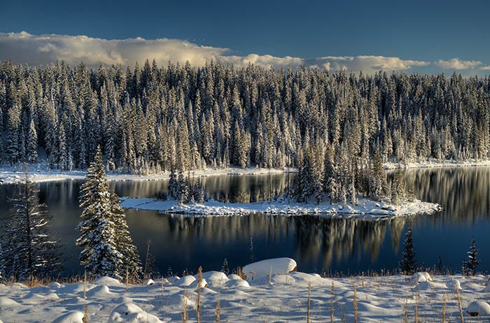
This is the same elevation as South Park. I had left South Park just in time.
The only other shots I took that day were of the Adobe Badlands down on the south side of Grand Mesa.
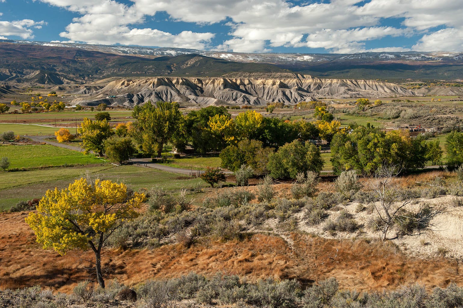
This photo merits a little bit of discussion. First, note the Grand Mesa in the background. See the snow up on top. That’s what I had just come through. Winter had arrived up there, but it was still fall down in Cedaredge, four thousand feet lower.
The Adobe Badlands is a large, deep deposit of Mancos shale deposited 90-some million years ago when this area was at the bottom of a large interior sea. It is mud and clay. Because it expands when it gets wet and shrinks when it dries, roots dry out and nothing can grow in it. And because it’s mud, it erodes quickly and easily. Yes, it’s the same stuff as that of Mt. Garfield and the Book Cliffs.
The Grand Mesa is capped by a lava flow that covered the Mancos formation, preventing the latter from eroding. Where there is no lava, the soft soil underneath it has been eroding away for millions of years. But the Mancos is thousands of feet thick, so some of it is still there, especially around Cedaredge.
So now you know about the Grand Mesa — a lava flow on top of mudstone — and the badlands around Cedaredge. Some years later, I lived in Cedaredge and did more photography there, which I shall post when this Substack gets to that part of my life. For now, these are the only photos I have for you today.