

Going to Moab

Part 1 is here. Part 2 is here.
I had been to Arches before:

And now I was living practically next door. Just a little over an hour’s drive away, depending on route.
Over the past two posts, I’ve told the stories of places to see on the way to Moab. There is A LOT to see there. I spent years there, living “next door,” and never did see it all.
Though this story speaks of a single trip to Moab, in reality the photos were taken on three trips, all taken in the same month.
Here’s the view just past the Arches National Park entrance station:
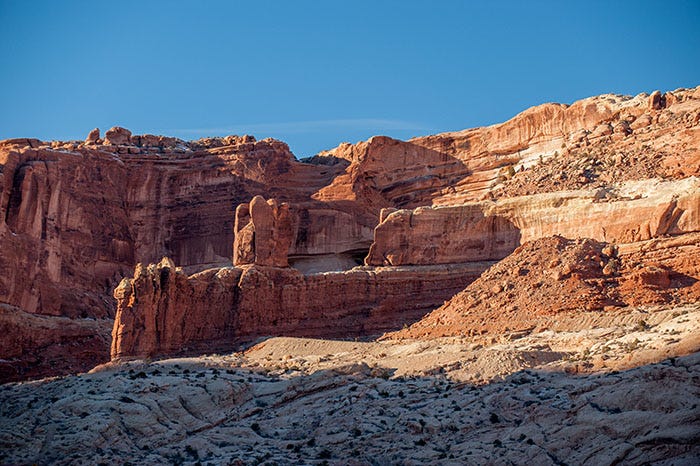
Here we have sandstones from three different formations. On the bottom is the distinctive white Navajo sandstone with its characteristic swirls (in shadow in the photo) and above it, the two formations that made all of the arches.
The next layer up is the Dewey Bridge member of the Carmel Formation. Above it is the “slickrock” of the Entrada Formation. The Dewey Bridge member was originally considered to be a part of the Entrada, but it’s now been reclassified.
How the Arches formed

Here’s an excellent photo of an arch-in-progress. If you’ll look carefully, you’ll see two different kinds of rock here: the bottom layer is somewhat crumbly, while the smooth stuff (that’s why it’s called ‘slickrock’; it’s not actually slick, it just looks that way) above is stronger and more resistant to erosion. So the crumbly stuff (Dewey Bridge member) erodes out from under the stronger, tougher Entrada Formation slickrock, leaving a hole underneath!
Here is the famed Double Arch:
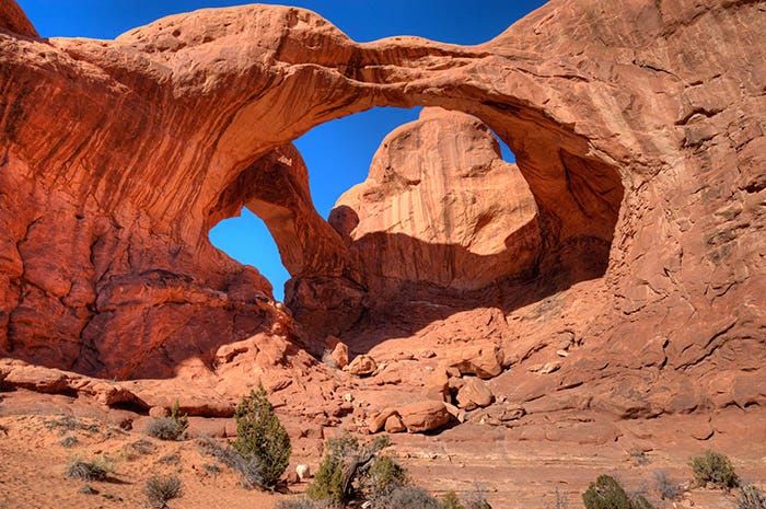
Paid subscribers received a full-sized, suitable for printing and framing, copy of this photo a week or two ago.
There is a large parking area at Double Arch, for there is a lot to see there. You could spend most of a day just in that one spot. For instance, Balanced Rock:
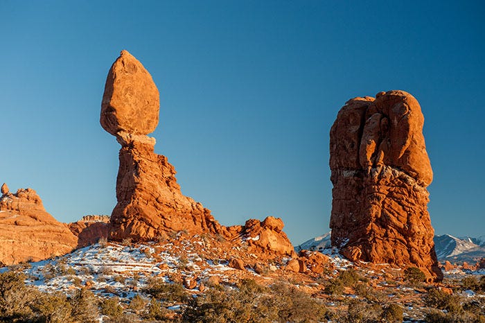
Note that this is the same geological story as above: a chunk of Entrada sandstone resting on a pillar of softer, crumblier Dewey Bridge sandstone. The pillar erodes faster than the sandstone on top of it. Turning the camera just a little to the right,
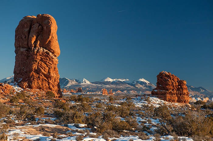
we see the La Sals. I told the geological story of these mountains (i.e., laccoliths) in my previous post. They are beautiful mountains, and mostly roadless.
Paid subscribers received a full-size copy of this photo, suitable for printing and framing, last month.
A very short walk away is Turret Arch:

I never saw the resemblance to a gun turret here. I would have named it “Keyhole Arch” or something. But that’s the name of it and as you can see, you can walk around inside and through it.
And now, Dear Reader, I have a special treat for you: a photosphere! Of the Double Arch, taken inside it. You literally have something to look at in every direction, including overhead! Click on this link, and use your mouse to look up, down, and all around:
It was getting late in the day. Time to head home to Grand Junction. Not a problem because I could come back to Arches any time I wanted.
I get the sense that the folks responsible for illustrating the legendary "Roadrunner & Coyote" cartoons were highly influenced by this area and probably spent a great deal of time there. The way they captured the essence of those features is plain to see and with your incredible pictures of the area, you once again make me want to walk right into the picture and stay a long, long while.
That photosphere is really bad ass, Ken!
Ken, this is wonderful! Your photography beautiful! 🙌🏻 I agree with Dave's comment! and that photosphere is very cool! ✨