

The Old Gordon Trail
The Old Gordon Trail
East end of the Colorado National Monument

At the east end (southeast corner of the triangle) of the Colorado National Monument is a spider’s web of trails, one of which goes to the Devil’s Kitchen. I wrote about Devil’s Kitchen here (Part 1) and here (Part 2)..
Another one of the trails leads up the bulge of the Uncompahgre Uplift to Glade Park, up on top. I believe it was used as a cattle trail before there was a road going up there. This one is named the Old Gordon trail. It affords some scenery.
The trail quickly parts from the Devil’s Kitchen trail and ascends along the Kayenta rock that caps most of the area. To the east, one can see a massive bluff of mostly Morrison Formation rock that was deposited on top of, and millions of years after, the familiar Wingate sandstone that is most of the National Monument.

Here’s a closer look at some of the layers:

You don’t get very far up the trail before you find yourself very near the Devil’s Kitchen, and looking down on it:
I have posted this photo before, in the older post that was linked at the top of this one.
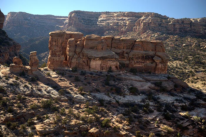
Turning to the east, one gets a better view of the Morrison Formation bluff that, as far as I can tell, has no name:

Note the Wingate sandstone at the bottom.
And now, looking more or less west, one can see the “Serpent’s Trail,” an old road of many switchbacks that wound its way up the side of the uplift (now a hiking trail) before they built the new road at the bottom of the photo:

This photo is a little bit bigger than the others. You can click on it to zoom in a little. You might even see the hikers on the serpentine trail.
This was about as far as I got up the Old Gordon trail. It was getting late in the day, I was tired, and I wanted to go home in daylight.
Gorgeous! Thank you!!
Love the trails around Fruita and CM. I’ve done some great mountain bike trekking through there—all the way to Moab back in my younger days. Just found your Stack look forward to reading more about my favorite part of the country. 🙏