

The Piñon Mesa

I have mentioned several times that the Colorado National Monument is at the edge of an uplift that occurred from 70 to 40 million years ago. That uplift, known as the Uncompahgre1, is a cigar-shaped feature about 90 miles long that lies on a diagonal line with the northwest tip of it, called Piñon Mesa, at Grand Junction.
There’s a road to Piñon Mesa about halfway across the top of the Monument. Of course, I had to go see what was up there. What’s up there is an old ranching community named Glade Park that still has its own post office and a little country store on the main road through the area, known as the “D South” (or D S) road.
I went up through the Monument to the store, and turned right (west toward Utah) on the D S road. I was behind the National Monument, about 7,000 feet above sea level, on mostly-flat terrain with some higher hills off to my left that I would explore later. On this day, I wanted to go out to the end of D S road, which goes west into Utah and ends at the Colorado River.
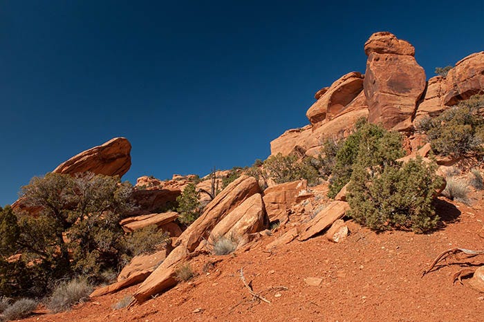
At the state line, the road’s name changes to “Triangle Road” aka “BLM 107” and the terrain changes dramatically from semi-arid ranch land to full-on desert wasteland not suitable for growing anything. It’s a desolate, isolated place where few ever go past the state line. There are crazy, jumbled piles of red rocks:
At this juncture, the smooth, dirt road follows the Dry Gulch fault that marks the southwestern edge of the Uncompahgre Uplift, with the Entrada and other sandstones on my right…
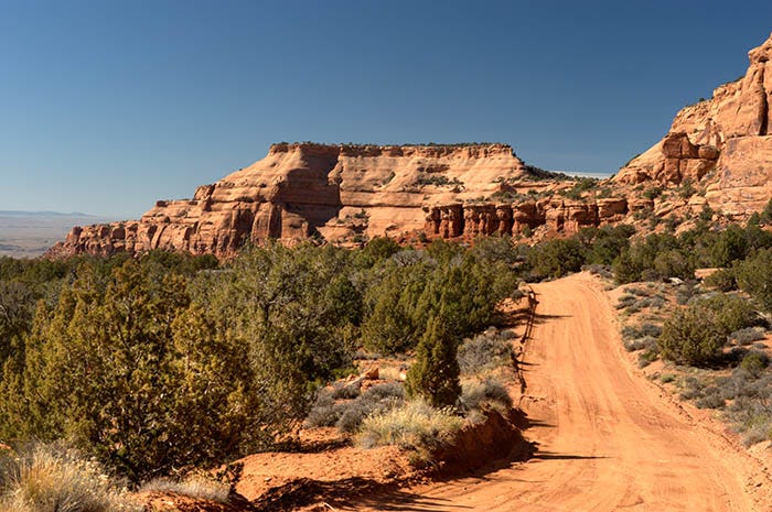
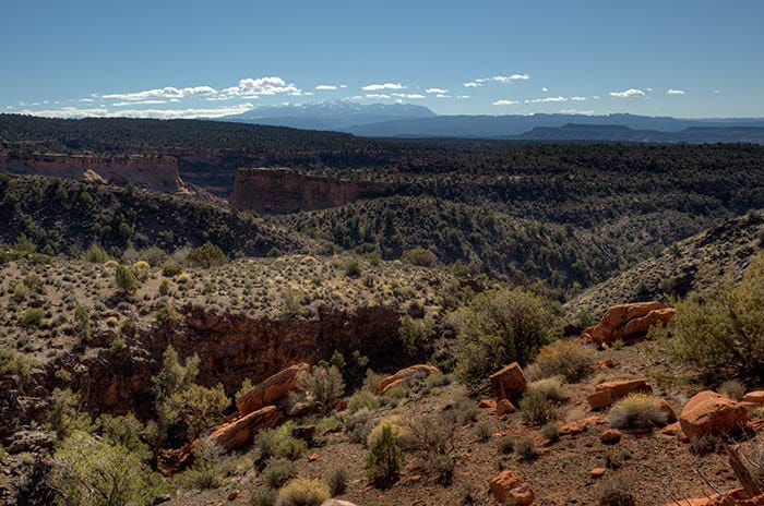
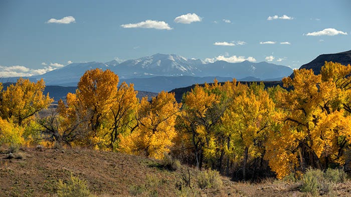
and the Sand Flats graben2 on my left, across which you can see for thirty miles all the way to the La Sal mountains (more on them below):
It’s the kind of place where you don’t need to find a place to pee. Just do it right out there in the open, ‘coz there’s nobody around for miles and miles and miles. You feel like Johnny Cash, breathin’ air that ain’t been breathed before.
From “Understand Your Man,” ©1964 Johnny Cash
The road continues along the fault, on the line between the uplift and the graben,
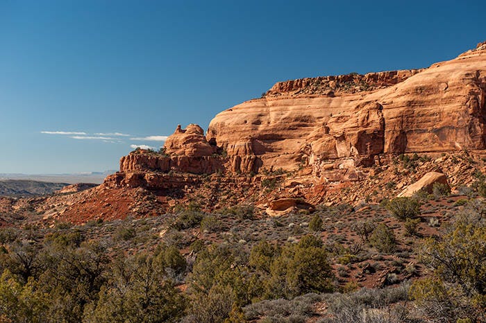
where we see the same rock formations you see in the Monument, but with different thicknesses: the brick-red mudstone of the Chinle Formation on the bottom, the sloping “slickrock” of the Entrada Formation on top, and what I presume is a short sequence of Wingate sandstone in between. Past the end of this bluff, the road passes above some spectacular gulches
on its way down
to the Colorado River.

This is a very remote stretch of the Colorado. Few people ever see it. People rafting Westwater Canyon get out a couple of miles upstream, and there isn’t any road below here until the river gets to Dewey Bridge. The road I was on ended just past here at what looked like somebody’s ranch.
The La Sal mountains are geologically interesting. They formed 28 to 25 million years ago, long after the Uncompahgre Uplift had finished rising. They are one of three laccoliths in this part of Utah: magma that rose from deep down, but never erupted above the surface. But the magma bulged and cracked the ground above it, after which the broken ground eroded away, leaving the lava exposed.
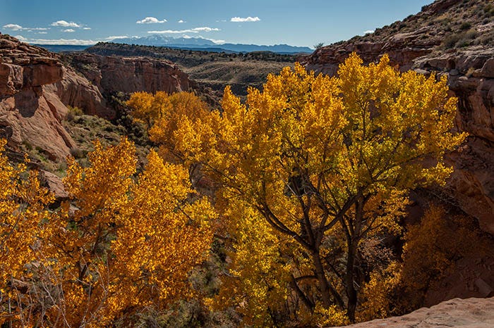
I turned around and headed back to civilization, taking this shot in Colorado near Glade Park as the sun was entering its Golden Hour.

Beautiful country, and I returned a number of times for more scenery.
A Ute word that means either “dirty water” or “rocks that make the water red.”
"Graben” (pronounced “graw-bun”) is a geologist’s word for a block of crust that has dropped lower than the other crustal blocks next to it.
"Thirty miles of nothing. Nothing but desert and canyons." Yeah, and a death sentence tro anyone caught unprepared out there. The desert is beautiful but lethal if not respected. Intriguing stuff as always Ken.