


A Big, BIG Road Trip
Day 3: Mesa Verde

In my previous post, here, I laid out the circumstances for this trip: going to California to work for Apple Computer. I had time to burn. I spent two nights at the Mesa Verde RV Park, which I highly recommend over anything in Durango, and spent a day in the Mesa Verde National Park.
The park entrance sits below an impressive bluff (see my previous post). Its name is Point Lookout. The road climbs the bluff and goes down the other side. Here’s the view from near the top.
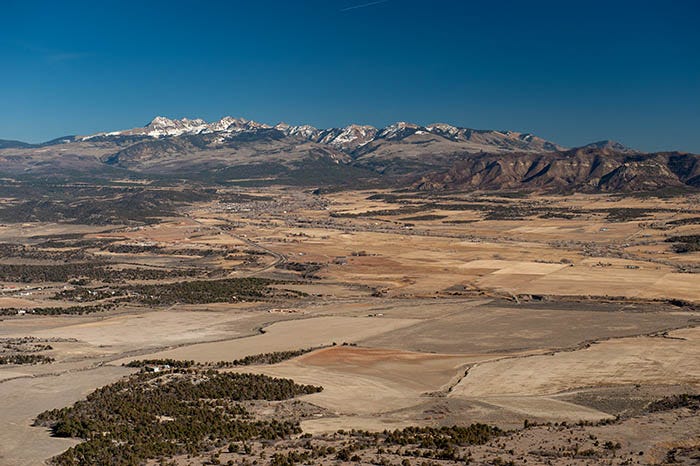
Here’s a view of the Mancos Valley and a part of San Juans, known as the La Plata mountains, from near the top. The town of Mancos can be seen on the valley floor.
From the top of Point Lookout, the land tilts to the south, down toward New Mexico, which is not very far away. The road follows the top of the ridge for a ways, offering spectacular views to the north into Colorado. Here’s another one:
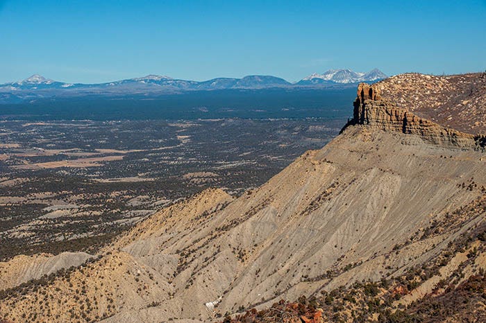
Here we have a bluff of Mancos shale, which is soft and erodes quickly, capped by the lowest member of the Mesa Verde group: Point Lookout sandstone. Directly behind Knife Edge is a three-peak cluster of the San Juans — Dunn Peak, Middle Peak and Delores Peak. On the left edge of the photo is Lone Cone; between it and the other three is Groundhog Mountain. From here, the road descends to the cliff dwellings themselves.
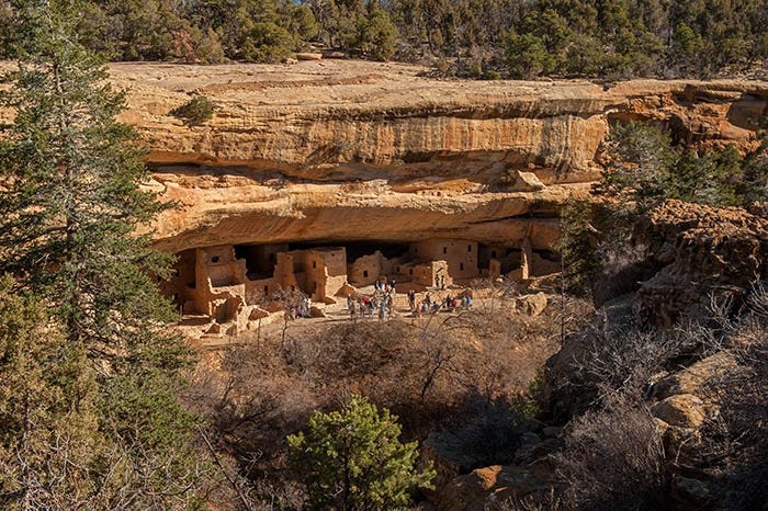
There are several clusters of dwellings throughout the park. For reasons I don’t understand, the NPS calls each cluster a “house.” I made my way to the only one that was open to the public on that day, the day after Thanksgiving: the Tree House. It’s named for some tree that is there. I don’t know which of these trees that is.
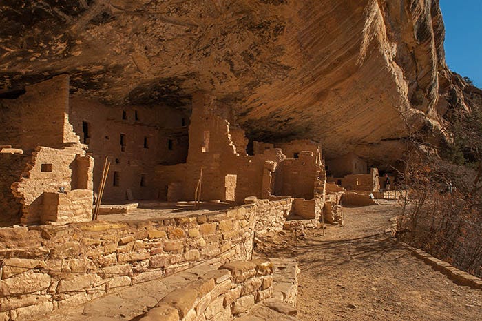
Here’s a view of the Tree House from down on its level:
And here is a wide-angle shot — a VERY wide angle — taken from the other end:
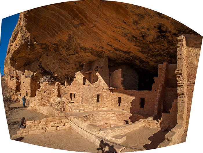
Note the circular basin in the lower middle, just above the camera’s shadow. There are several of these in all of the dwellings in the Park. They are called Kivas, and were clearly important to the people living there. It is believed that they served a religious or ceremonial purpose.
The Park Service has restored one of them, and the public is allowed to go down in. Here’s my Inside A Kiva shot:
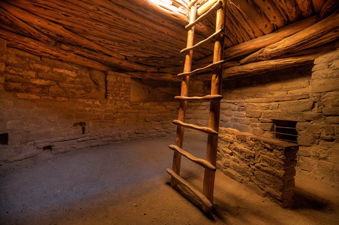
I’m pretty proud of this shot. The only light coming in is through the hole in the roof, which makes exposure very difficult. But I got the shot.
Paid subscribers received a full-size, suitable for printing and framing copy of this image a couple of months ago. Even if you are not a paid subscriber, you can buy a large, fine-art print of this photo from Fine Art America.com
It was getting late. But I took the “long way” home, around a loop road that afforded a view of some other, inaccessible dwellings that the archaeologists say were the last ones constructed before the entire place was abandoned: the Square Tower House. Not sure how the inhabitants got in or out of there:
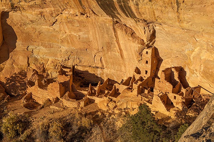
Note the presence of at least three Kivas there, with what looks like a fourth that was under construction when the place was abandoned.
Certainly an interesting place, and an archaeologist’s paradise.
To be continued…
You sent me a panorama from inside the Kiva shown above. It is a magnificent view of the place, the warm colors and exquisite detail made me feel as if I was there. Quite an amazing shot. Thank you!