


In my prior post, I spoke of the 100-mile trip in my motorhome, towing my Jeep, to Buena Vista from my home in Indian Hills. It was on a Saturday.
The next morning, I headed out in the Jeep to see what the highly-vaunted four-wheel-drive (4WD) trail over Tincup Pass was really like. To get there from Buena Vista, you go south on US Hwy 285 a few miles to a little bitty place called Nathrop and hang a right up Chalk Creek, which flows through a deep canyon between two Fourteeners.
In my prior post was a shot of those two mountains from the RV park. Here’s one of them, Mt. Princeton, up close:
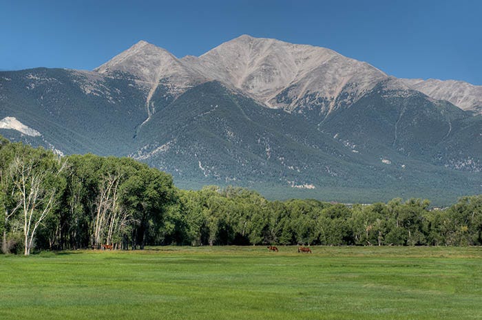
An awe-inspiring piece of rock, for sure. At the little burg of Nathrop, you take a right onto county road 162 and proceed to the gap between this mountain and the other Fourteener, Mt. Antero, that is right next to it. First thing you get to is a hot springs resort: a sign of continuing geologic activity. I kept going.
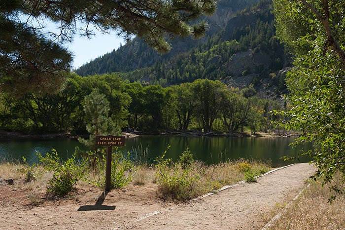
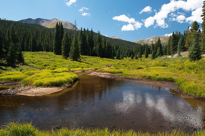
Next up the canyon is Chalk Lake. It was worth stopping to photograph.
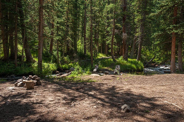
There is a nice campground there. My favorite, though was the next campground up the creek. Near that campground is a series of cascades in the creek that are beautiful. I spent quite a bit of time there photographing them:
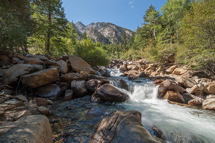
Paid subscibers received a full-size copy of this photo, suitable for printing and framing, a couple of months ago.
At this point, the road is still paved. Somewhere past here it turns into a well-maintained gravel road. It doesn’t become a gnarly 4WD road until you get to the “ghost town” of St. Elmo.
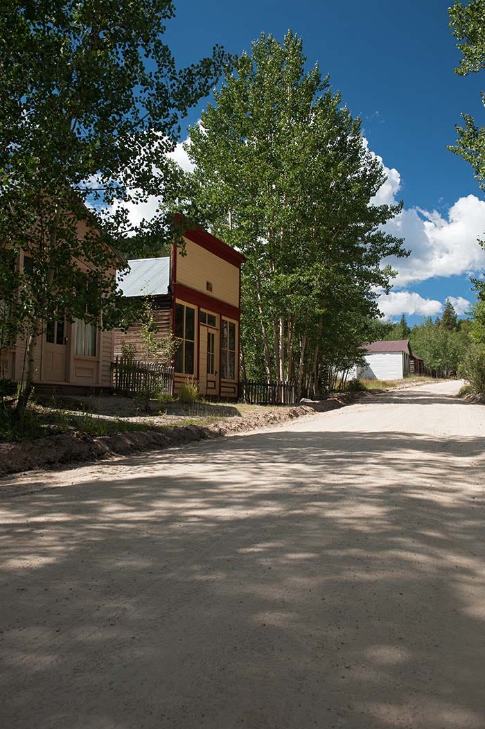
It isn’t much of a ghost town; there are people living there. I like to refer to them as “lively ghosts.” It’s a picturesque place: all the buildings are from the late 1800s when it was a booming mining town. Some have been kept up and some are abandoned.
I could have spent an entire day there photographing that town, but my goal was Tincup Pass, which is one of the more popular 4WD trails in Colorado. So onward I went, locking the Jeep into 4WD at the far edge of town, and proceeding up the North Fork of Chalk Creek. It’s a pretty drive.
And here’s a pretty little spot where someone made a roadside camp. But I wouldn’t camp there if I were you.
You see, Tincup Pass is a zoo. It seemed to me that half of the city of Denver was up there that day. You’re not going to get any peace & quiet camping along that road.
A few miles later, crawling along at about walking speed and choosing one’s lines of approach between, among and over the rocks, one comes to the top. Here’s a phone shot of it:
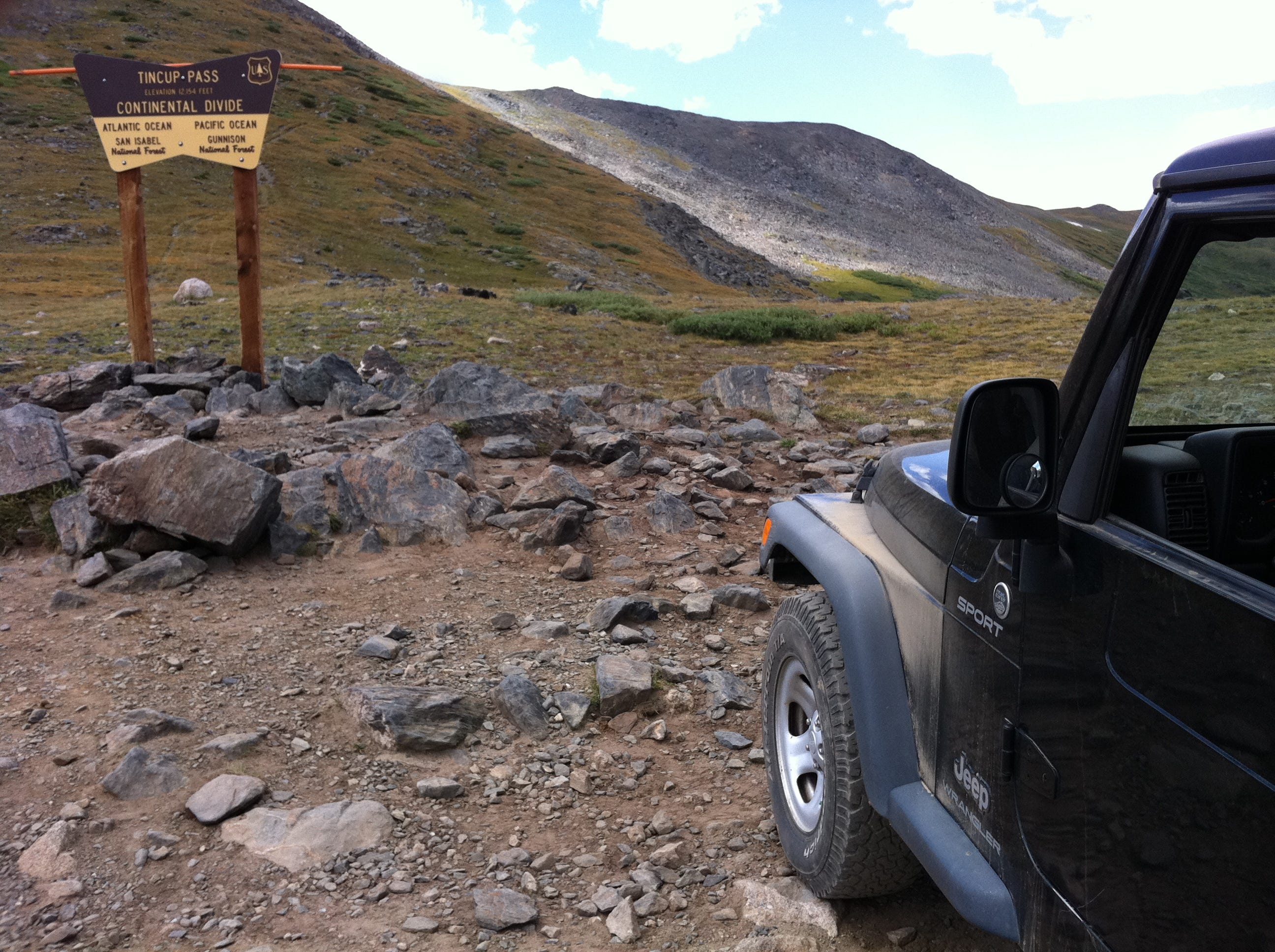
If you zoom into the photo by clicking on it, you can read the sign. As you can see, it’s not a particularly high pass — only twelve thousand feet and change — many of Colorado’s Continental Divide passes, which are paved, are higher. And it’s not a particularly difficult 4WD trail: my Jeep was “bone stock” as Jeepers call it (unmodified from the factory) and it had no problems. It’s just a very rough road with lots of rocks. This - the fact that you don’t need a “built” Jeep to do this trail - might be why it’s so popular.
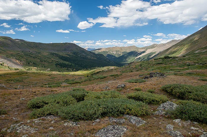
Here’s a view looking back down the Atlantic side of the pass, which I had just climbed.
To be continued…
The photos in this group, especially Mt. Princeton, are breathtaking. In my estimation, these are your finest that I've seen, but I missed a few earlier posts going back a couple months. I will read them all soon as I will finally have time to give your posts the detailed examination they deserve. Such as zooming in and closely gazing into the amazing photos and reading your well-written prose. I really love all the content you have been issuing on these road trips. Fascinating.