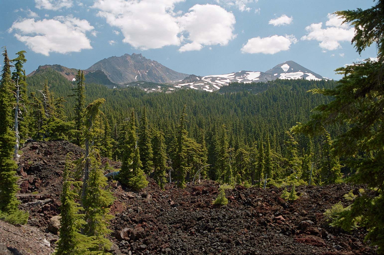
Obsidian Area, 3 Sisters Wilderness
An epic backpacking trip

I was 52 years old, and obese. And determined to take my Little Guy (who, at 14, was not so little any more) on one of the most breathtaking hikes in Oregon: the highly restricted Obsidian Area at the base of the Middle Sister.
We headed up the road, and stopped at the ranger station to get our permits to be in the restricted area. ACCESS DENIED: The area was full. “But we have an opening for the next two nights,” the ranger helpfully added.
“Well, I guess we can take that other trail, camp somewhere outside of the restricted area, and then sidle over to it,” I replied.
And just like that, our plans changed. Here’s an overview - a screenshot from Google Earth - of where we went:
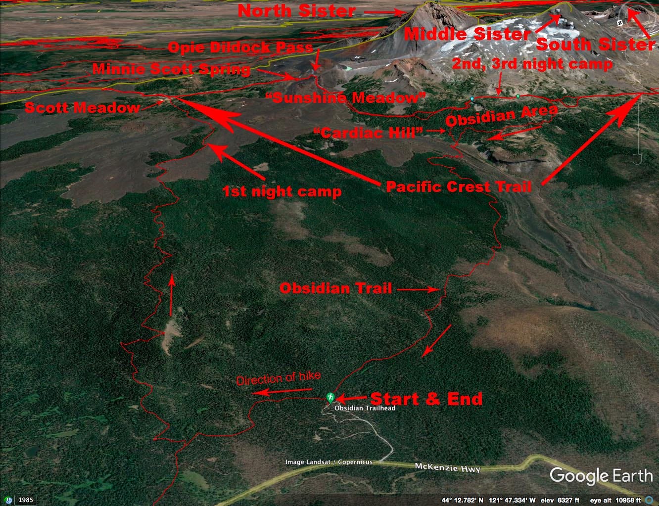
I had been to the Obsidian area before, up & back on the “Obsidian Trail.” The rest of the hike was new to me.
Aside: For what it’s worth, the entire Three Sisters Wilderness is restricted now. Only a certain number of people are allowed in each day, and you have to get a Permit well in advance. You obtain that through the Government’s camping reservations website, recreation dot gov.
We started on our journey. The air was clean, the trees were green, everything was just keen.
I got tired. I ran out of water (if I remember correctly, I only had one 1-liter bottle at that time, and hadn’t yet figured out the little trick of sticking the water bottle in the freezer two days before a trip). It was getting late. We got to a wide spot in one of the little groves of trees, with a snowdrift still up against the lava flow, and I announced “This is the place.”
We made camp, lit a fire and proceeded to make dinner and melt snow.
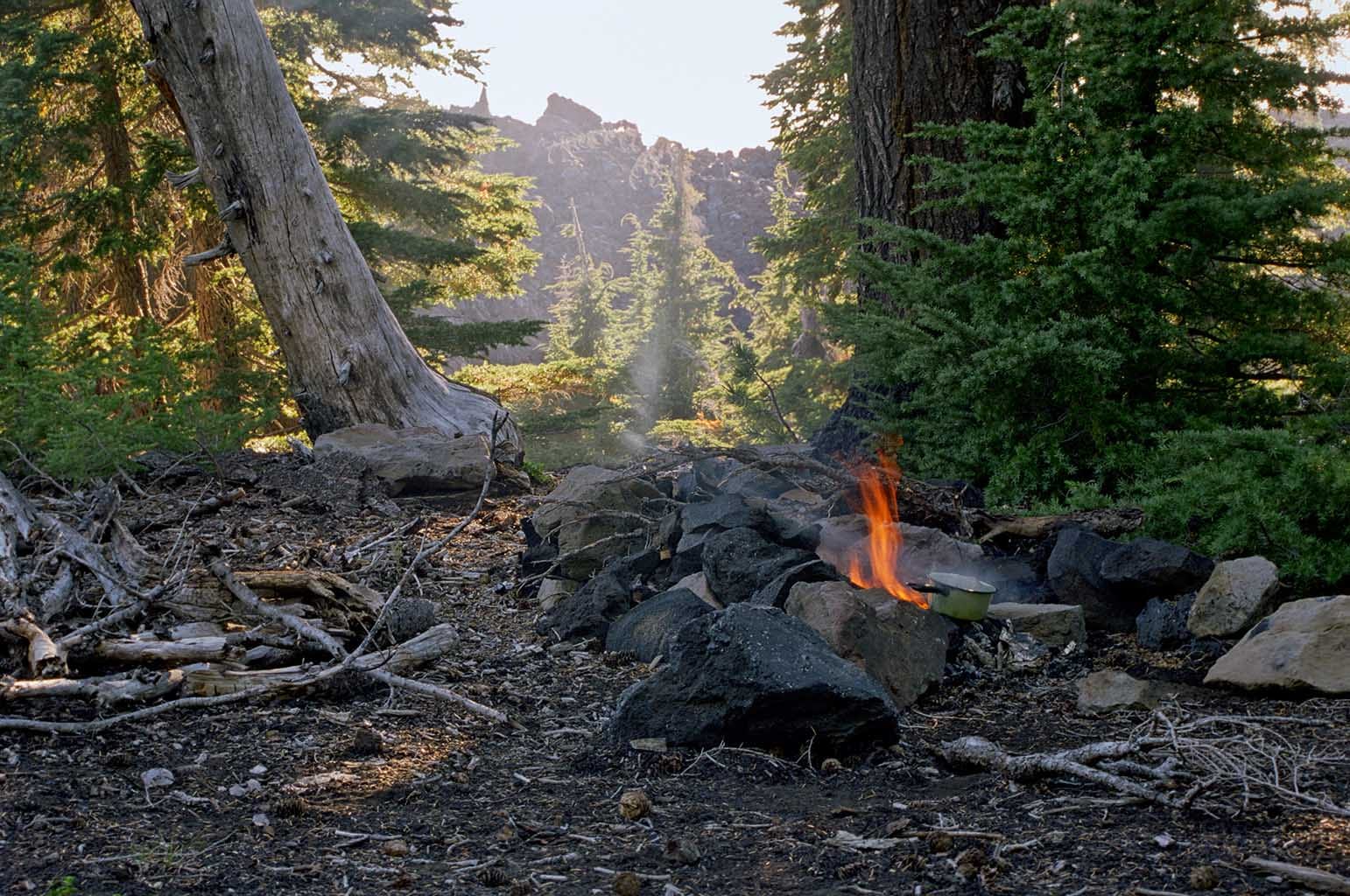
Ashes fell into the little saucepan while we melted, and then boiled (to disinfect it) the snow. For the next day, I had to drink water that tasted like charcoal.
But we were in the Wilderness. It was quiet and it was peaceful. We had everything we needed: food, water and shelter. Life was good. SO good. Life is always good in the Wilderness, unless it’s raining or something. Looking at this picture of camp still brings back feelings.
Scott Meadow
The next morning, it was a short uphill hike to Scott Meadow, where we joined the legendary Pacific Crest Trail. That’s the trail junction at the rustic sign.
In 1862, Felix Scott Jr. built a crude road through here. We dropped our packs here, ate lunch, and spent a bit of time just wandering around. I was getting low on water.
The Pacific Crest Trail proceeds southward, and upward, from here up that little draw at the far end of the meadow. I was getting thirsty.
Minnie Scott Spring
I have never been able to find out just who “Minnie Scott” was. I’ve gone through Felix Scott’s family tree and there’s no Minnie. But whomever she was, this pure, cold, delightful spring was a welcome sight. I drank deeply, and filled my water bottle.
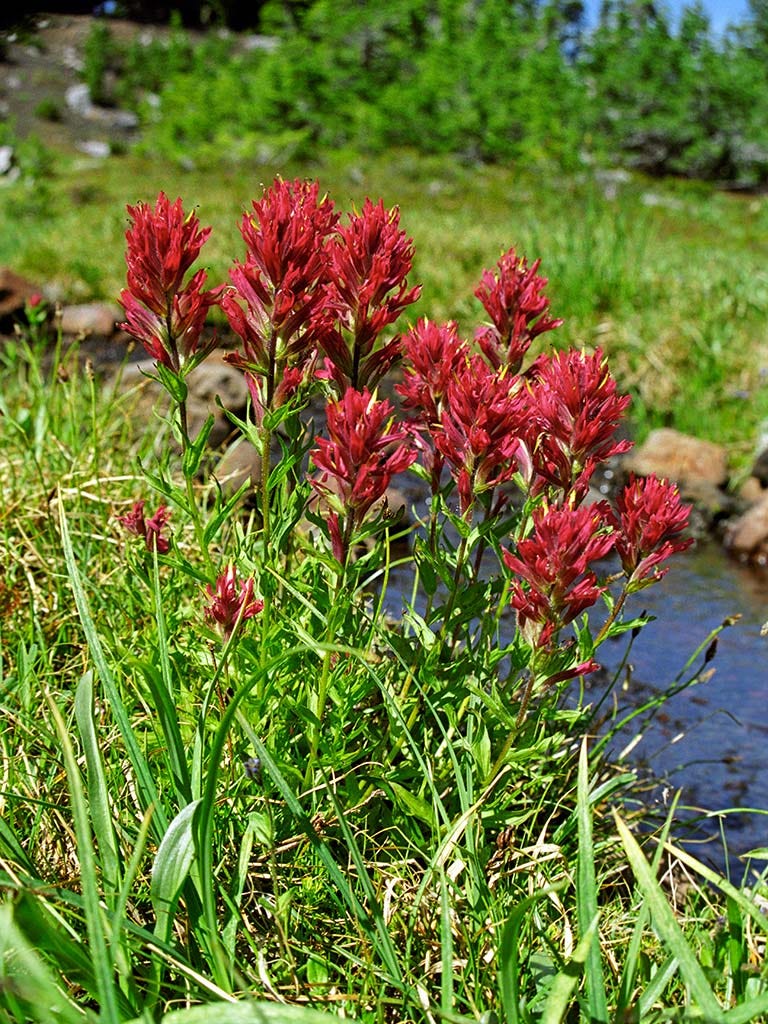
The red flowers are traditionally called Indian Paintbrush, but the plant is now known only as “Paintbrush” thanks to Political Correctness.
Opie Dildock Pass
The men who laid out the old Oregon Skyline Trail, now known as the Pacific Crest Trail, had a heck of a time figuring out how to get around the extensive lava here. It’s darned hard to build a trail over the stuff, so they looked for a way to snake around them. They chose a narrow neck of this one huge, fan-shaped flow way up high on the mountain, to get across it. They named it after a 1900s cartoon character who “was known for finding his way out of difficult situations.” It’s a long climb up (left side of photo) and a much longer, and steeper, climb down.

That is Collier Cone on the left, and the North Sister on the right We are looking pretty much south here.. Turn around for the view to the north, and you see all the way to Mt. Hood, eighty+ miles away:
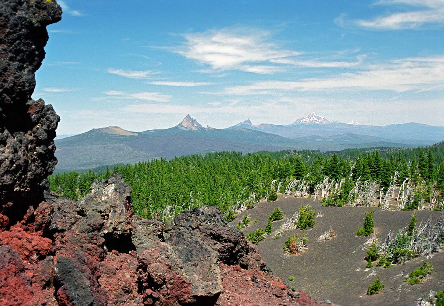
From left to right: Belknap Crater, Mt. Washington, Three Fingered Jack, Mt. Jefferson, and peeking over the shoulder of Jefferson, the tip of Mt. Hood.
Sunshine Meadow

A short hike after the grueling descent off of Opie Dilldock (but I’m glad I wasn’t going the other way!) one comes to the boundary of the (formerly) Restricted Area. At the time of this trip, you were allowed to hike through it during the daytime, but needed a permit to spend the night. Camping was, and is, forbidden in this meadow.
The sign marks the junction of the Pacific Crest Trail, which crosses the photo left-to-right, and the “Cardiac Arrest” trail, which descends steeply behind the camera.
We spent the next two nights off the right edge of this photo, up on top of the obsidian flow, the only place where camping is permitted. The scenery is unbelievable, made even more so by the effort it takes to get here. A pure, cold creek coming out of a glacier provided all of our water.
While I took dozens more photos here, all I have to offer at this juncture are the ones that I have scanned. Yes, this was still back in the Film Era.
On the way down via the usual trail (#3528, the Obsidian Trail - see the Google Earth screenshot) is a small site where a camp could be made, except that no one ever camps there. It is at the junction of trail #4336, which is a very steep shortcut to Sunshine Meadow. A group of Eagle Scouts were eating lunch there, and told us that they’d renamed that shortcut “Cardiac Hill” because a scoutmaster had had a heart attack on it! To this day, that’s the name I remember it by.
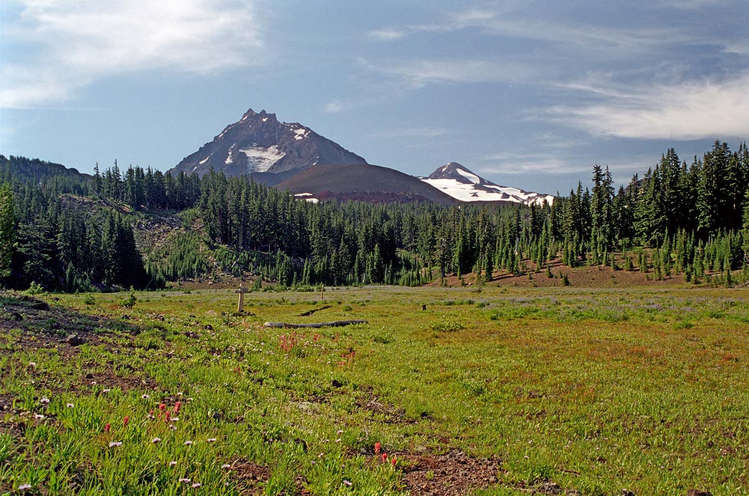
Here’s one more shot that I took on the way out. This is a little bit below Cardiac Hill. To my recollection, it’s the last good, clear view of the North and Middle Sisters before descending into the timber.