


Red Mountain Pass
US 550, the most beautiful road in the Lower 48

US Route 550 has been called “the Switzerland of America” and is officially dubbed “the million dollar highway.” I don’t know why, because it basically costs a million dollars per mile to build a highway. It stretches from Montrose, Colorado almost to Albuquerque, New Mexico but this post is about the legendary stretch from Ouray to Durango, Colorado. It’s the most beautiful road I’ve ever been on, but then I haven’t been to Alaska.
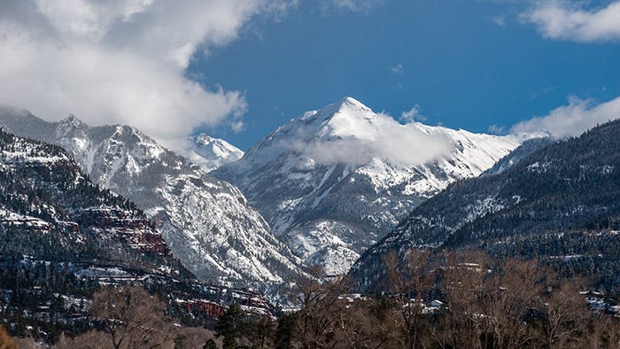
Spring had sprung down in the Grand Valley, only about 4,500 feet above sea level, but it was still winter up in the High Country of the San Juan mountains at 11,000 feet. It was my first time on that legendary road, and the “Oh my god, stop and take a picture” scenery began before I even got to Ouray:
Paid subscribers received a full-size, suitable for printing and framing, copy of this image a month ago.
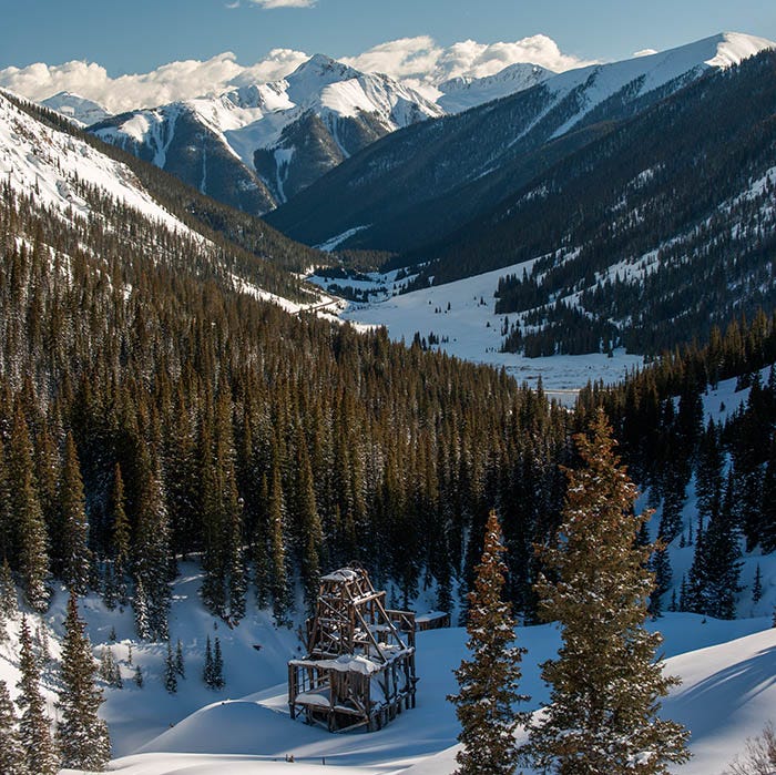
The San Juans were formed well after the Rockies were, by a different process and made of different materials (volcanic lava, ash and tuff) than the Rockies; they are steep, rugged and young. I made many trips up there during my time on the West Slope, but this Substack post is only about that first trip.
DO NOT TAKE AN RV OVER THE PART OF THIS ROAD BETWEEN OURAY AND SILVERTON!! Park the RV and take your toad across. People have died trying it, and there have even been a few divorces because someone drove an RV across it (and lived). That is the most scenic part of this road, but do it in something small.
OK, let’s go up over the top. Here’s the view down the other side (toward Silverton) from the top:
Paid subscribers received a full-size, suitable for printing and framing, copy of this image a couple of weeks ago.
Silverton is almost 2,000 feet below here. The highway snakes down this valley, goes past one end of town, and then climbs again through more mountains on its way to Durango. Soon, a view of the Grenadier Range comes into view:
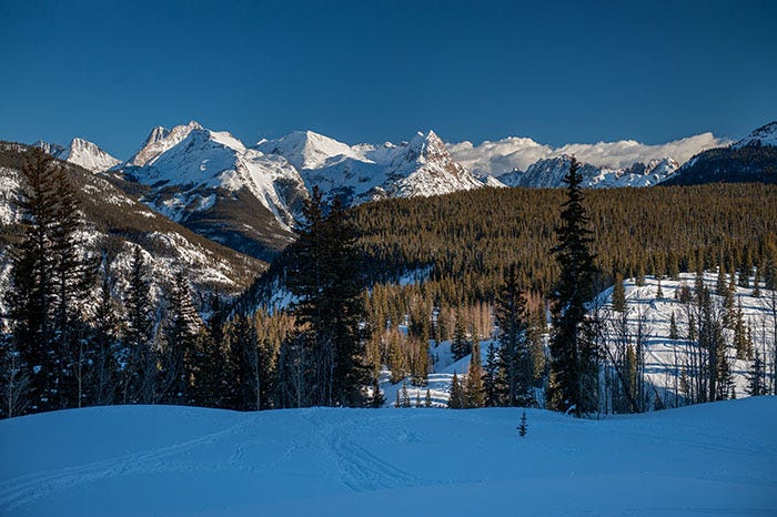
These peaks are in the Weminuche Wilderness, Colorado’s largest at half a million acres. Oh, how I would like to go hiking, backpacking and exploring in there! Not in winter, of course.
It was getting late. I turned around and headed back to Silverton, stopping to take a picture of town before I got there:
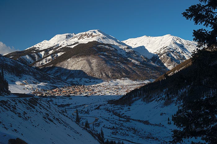
As you can see, Silverton is a little town nestled in a valley, surrounded by Thirteeners. A beautiful town, a picturesque town, a town surrounded on all sides with adventure. I drove on down to the far side of town and took a shot looking back the way I had just come:
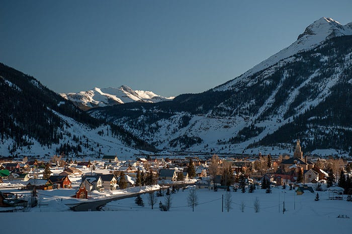
The low peak in the photo center is Snowdon Peak; the one at the right edge is Grand Turk. Both are Thirteeners. You can see Hwy 550 making its way up the side of Grand Turk to the spot where I took the shot of the Grenadiers.
It was getting late and my light was almost gone for the day. I had finally seen Hwy 550, it had captured my soul, and I made a number of trips up there in the next few years.
I am so excited to get out there this June! Amazing shots 😍
I watched a CDOT video of a snowplow get taken over the side by a slide once.
Love that road and area. Motorcycle camping ⛺️. One of my favorites 4x4 roads from Ouray over the top to Telluride.
Thanks for the cool reminder of those memories.