


The Elk Mountains, Part 1
Morning: the road to Paradise Basin

This is the second post of my second trip to Gunnison, Colorado. I took so many photos that day that I have to split the photos from it into two posts.
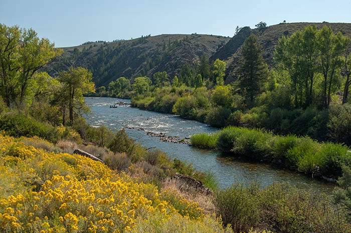
The long day started with a fine morning, heading up the Gunnison River toward Crested Butte. Here are some guys fishing in the Gunnison:
I had been this far the day before, and had taken the Taylor River to Taylor Park. On this day, I went up the East River (which ironically is west of the Taylor) towards Crested Butte. I stopped to take this shot of Crested Butte the mountain:
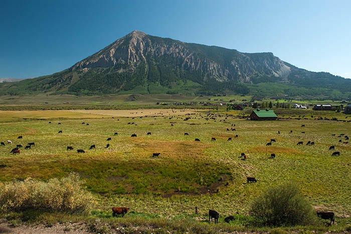
It’s a handsome peak. It’s not a tall mountain - it doesn’t even make it to a Thirteener - but it’s kinda out there by itself, standing apart from the rest of the Elk Range.
And… it’s a laccolith. Laccoliths are mountains that formed from lava, underground. The volcano never broke through the surface. All of that lava came up, bulged and cracked the ground above it, but never broke through. Then the cracked ground above and around the laccolith eroded away, leaving the mountain standing there.
The town of Crested Butte which is just past this mountain didn’t impress me. I passed through it without taking any photos.
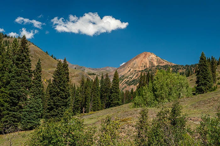
There are a couple of ways to get to Paradise Basin from town. I chose the route up the Slate River. Cinnamon Mountain came into view. When I would get up there to it, I would be at the rim of Paradise Basin.
The Slate River was becoming a creek. A picturesque creek.
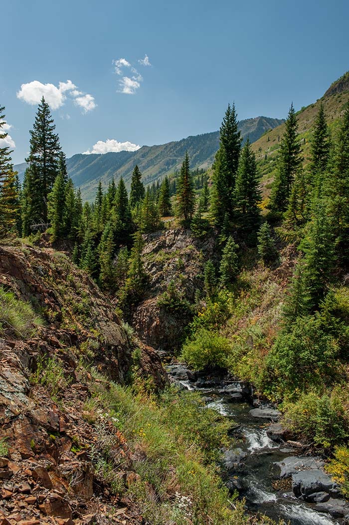

Near this spot, the road turns and ascends up the side of the canyon. The upper Slate Canyon comes into view:
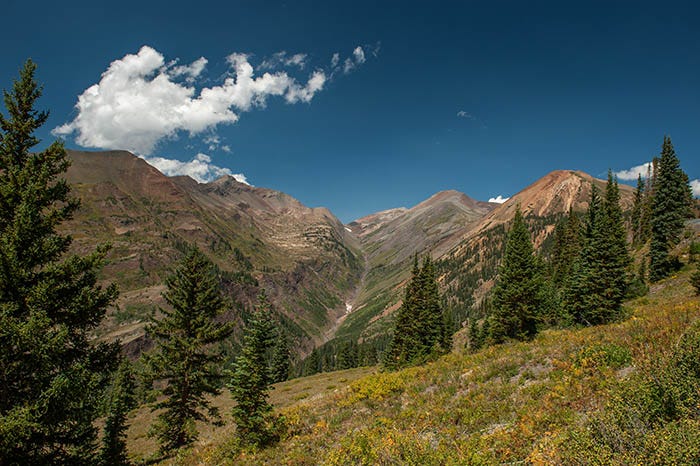
Prominent peaks left to right are: Purple Mountain (which is the purple one and also the rocky peak behind it), Treasury Mountain and Cinnamon Mountain.
And then the road climbs over the rim into Paradise Basin. And here is Cinnamon Mountain, with a little lake!
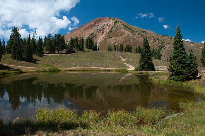
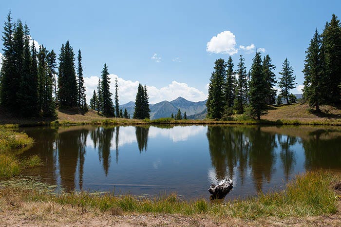
Another view of the same lake:
And there, I saw someone painting:
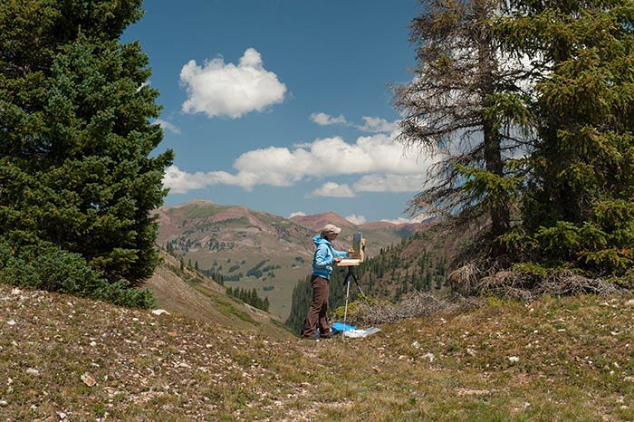
I got a model release from her, and Getty sold one license to this image. Somewhere, in some magazine, she is famous! Here is what she was painting:
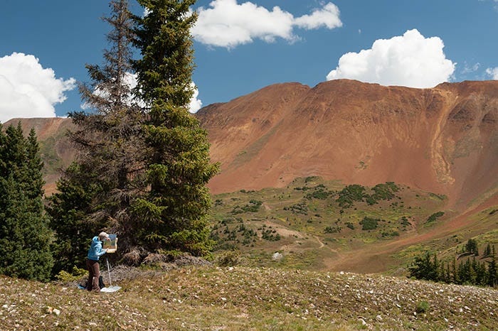
That area below, between the camera and Mt. Baldy, is Paradise Basin. No idea why the miners named it Paradise. Maybe there was lots of gold or something. It didn’t match my idea of Paradise!
This post already has far more photos than I usually try to cram in. But wait! There’s more! I also took a photosphere up there.
Now you, too, can stand at the edge of Paradise and look in every direction:
As usual, you have to leave Substack to see it. Substack doesn’t render photospheres.
It was a beautiful day, and it was only half over. Next, I went down the deadliest 4WD trail in Colorado. Dozens have died trying to traverse it.
To be continued…