


The Cimarron River
In the San Juan mountains

The name Cimarron evokes a certain mood among aficionados of American cowboy movies and television shows. Colorado has two Cimarron Rivers; this post is about the short one that is barely over twenty miles long and feeds into the Gunnison River.
It rises high in the San Juan mountains and flows down three river forks, in a pristine wilderness, that join at Silverjack Lake. Separating this rugged and spectacular country from civilization to the west is a series of mountain ridges that are freqently mistaken for Cimarron Ridge, but Cimarron Ridge is only one of them.
There are two ways in to this country: Going south up the Cimarron River from its mouth at US Hwy 50 where it flows into the Gunnison, or east from US Hwy 550 near the town of Ridgeway, crossing what is commonly mistaken for the Cimarron Ridge.
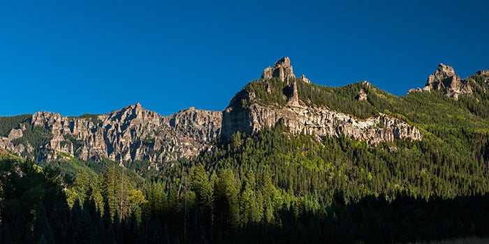
Here is what most people think is the Cimarron Ridge:
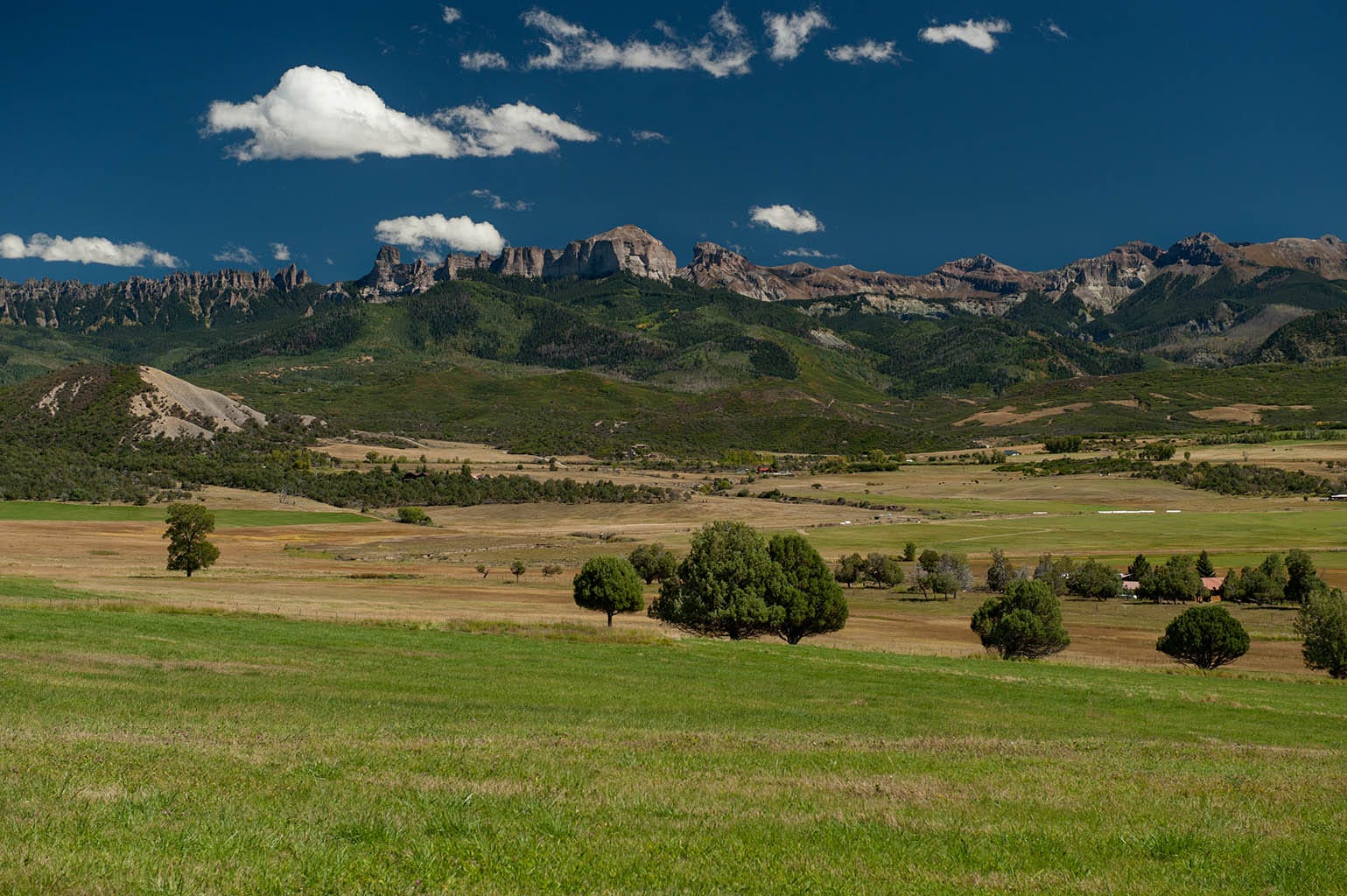
Cimarron Ridge is the series of pinnacles on the left side of the picture. From this view from US Hwy 550 near the town of Ridgeway, this looks like one continuous ridge stretching all across the photo — but it isn’t. There are actually three separate ridges in this photo, with one in front of a gap between the other two.
I had driven by this spot a number of times and even stopped to photograph it and was fascinated with the strange shapes up there. Well, there is a road that goes up there. I was driving a Jeep. I went up there.
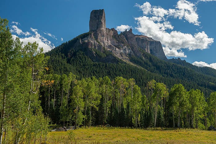
Basically, you take County Road 8, across from Ridgeway State Park, up and over Owl Creek Pass, which is just to the north of Chimney Rock. Here is what it looks like on the way up:
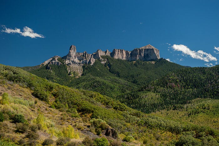
If you’ll compare this shot to the one above, you can see exactly where we are in this photo: this is the little short ridge that is in front of the other two.
Chimney Rock looms large as you approach Owl Creek Pass:
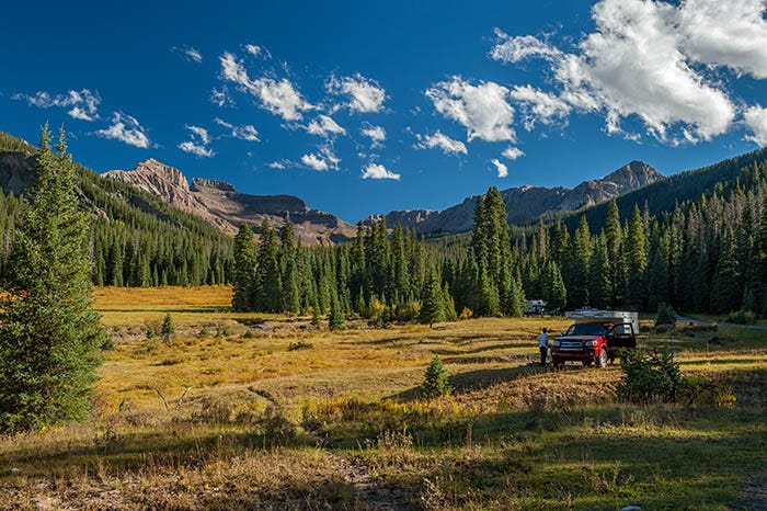
The pass is a very short distance off the left edge of this photo. Once over it, you are in the West Fork of the Cimarron. It is beautiful country, with another ridge behind it.


Up the West Fork of the Cimarron. Left: Dunsinane and Precipice Peak; right: Precipice Peak, Redcliff and Coxcomb. Click either photo to zoom it.
It is God’s Country. What a gorgeous place to camp! And people were camping there.
Following the main road downstream, you come to the junction of the Middle Fork and East Fork of the Cimarron.
And, as you can see, there is yet another ridge behind this one.
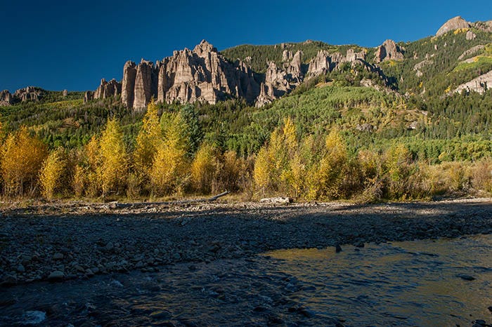
Down near Silverjack Lake, the canyon walls are full of pinnacles of volcanic tuff.
It is definitely paradise up there. I would return in a few weeks and shoot the aspens at the peak of their color.
This post contains far more photos than the usual. It will be a little longer until the next post.
Breath taken. Jaw dropped. Thank you for the higher-res shot of Cimarron Ridge (top image). One thing I keep noticing about the Colorado pictures are how you capture the clear, deep blue sky contrasting the bright white clouds causing the landscape terrain to stand out.