


The historic Skyline Road
Part XX of Another Trip to Oregon

This post is about the last 17 miles of the old Skyline Road - or, in the direction I was going, the first 17 miles of it. The Skyline Road was a Forest Service road (Road Number 4220) that ran near the summit of the Cascades from Mt. Hood almost to Mt. Jefferson. It is still on most maps. Parts of it have been impassable from time to time.
And a two-mile stretch of it at the southern end isn’t even on Forest Service land any more. That is quite the little tale all by itself, and I shan’t tell it here. Short version: there was a surveying mistake back in the 1850s… that wasn’t corrected until 1972…
It is one of the great stories of the American West, that you should look up and read about. Put “McQuinn strip boundary dispute” into a search engine to read all about it.
The result is that, since 1972, Breitenbush Lake, Gibson Lake, Spoon lake, and two miles of the old Skyline Road are now owned by the Confederated Tribes of Warm Springs. Further, that end of the Skyline Road hasn’t been maintained in at least fifty years (because I was up there fifty years ago, and I remember) and it is rough, rough, ROUGH. We used to go up there in Mom’s car to be dropped off or picked up for backpacking trips. I wouldn’t take a car up there today. But on the day of this story, I had a recently acquired Jeep®.
I had camped at Breitenbush Lake many times over the years. Here is the only part of Breitenbush lake where Whites are still allowed:
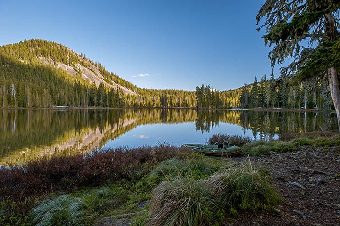
It’s an old campground that was built by the Forest Service back when they owned it. I remember an old Indian medicine man I’d met up there decades earlier, telling me not to go up on that butte on the left side of the photo: he said it was sacred.
On this day, there was a blond-haired, blue-eyed Indian camping up there. He introduced himself as “Ken.” I stared at him.
“What’s the matter?” he said.
“I was up here years ago, and met an old medicine man,” I replied. “His name was Ken.” Couldn’t possibly be the same person.
“That was my dad,” Ken replied.
I never asked how a Tribal member could be a blue-eyed blonde.
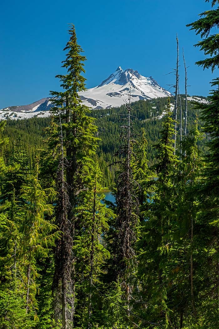
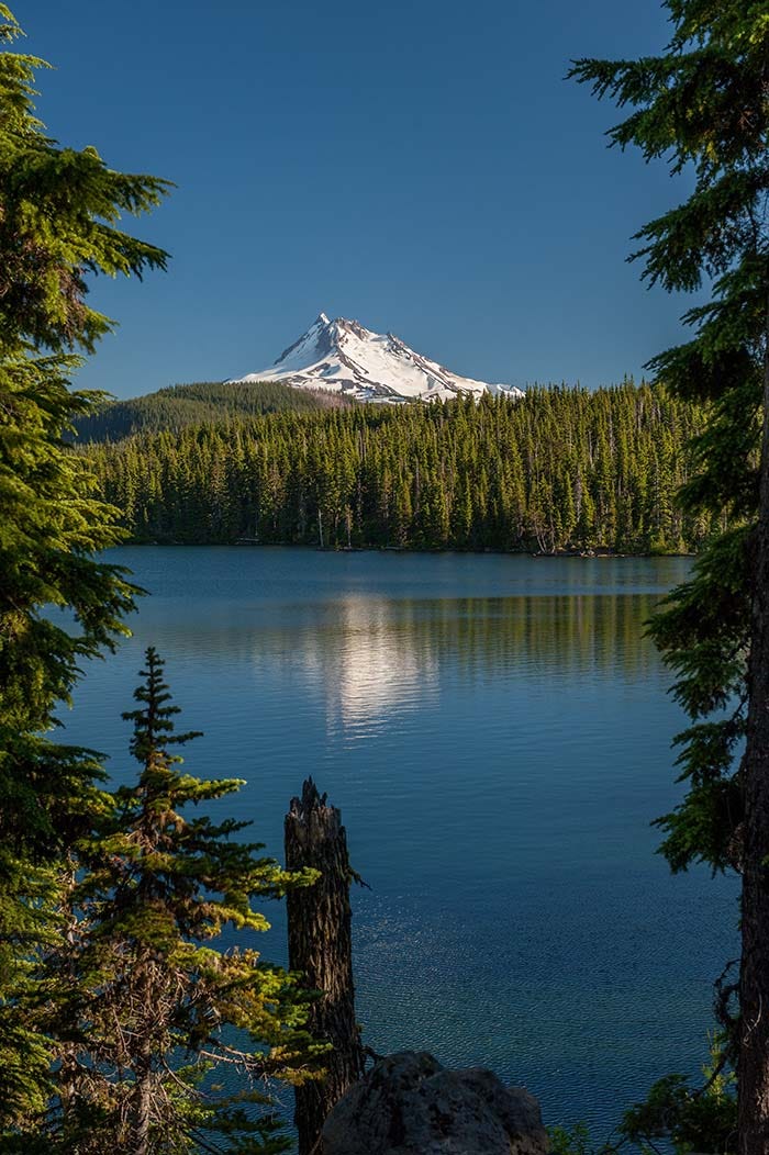
Here is the spot on the lake where I used to camp. There’s a nice view of the mountain there:

The old Pacific Crest Trail (which was moved after the Reservation boundary was moved) came down off a hill behind the camera from this spot. Up on top of that hill was a magical place that I wanted to see again: Gibson Lake.
The old trail was still there, and it was still open to white people (though camping there is now forbidden).

I wanted to see it again because, when I came through there as a teenager, I overexposed all my shots!
It was hard to find a spot where you can see the mountain through the trees. But there’s probably a clear view now! All those trees burned in the Lions Head fire of 2020.
Here’s a shot from the other side of Gibson Lake; you can see Breitenbush Lake down below.
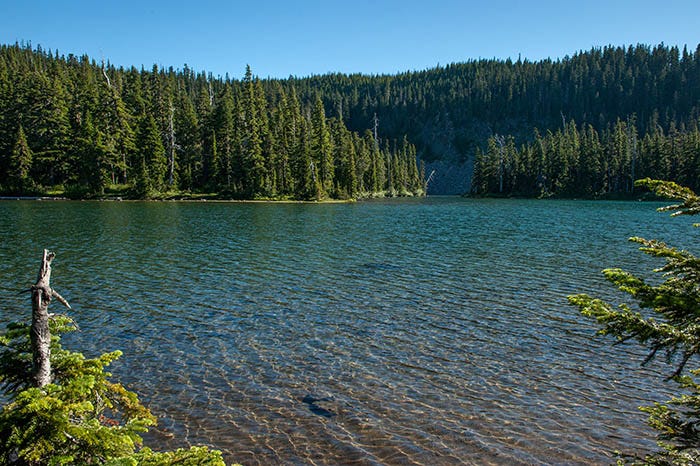
Not far down the road is Spoon Lake. It’s pretty enough, though it’s more a pond than a lake, and no you can’t camp there:

From here, the road descends steeply, affording a nice view down into the basin that holds Olallie Lake and several others.
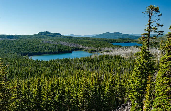
I remember getting depressed about the small area of burned timber at the right edge of the photo. That is on Tribal land - the boundary runs just this side of both lakes - and I was disappointed that they didn’t take better care of their lands.
Now, this entire area is gone. In September of 2020 the Lions Head Fire, which started on Tribal land, roared through here and burned EVERYTHING. Everything in this view except that distant hill, Sisi Butte, is now nothing but ashes.
The fire burned all the way to Detroit, and destroyed that town too.
The road crosses the boundary back onto Forest Service land at Horseshoe Lake, which really is shaped kinda like a horse shoe. Here is one half of it, from the middle down to one end of the horseshoe:
The Pacific Crest Trail goes along the ridge in the background. Sometimes, through-hikers will come down to this lake to camp.
Further along the road is Olallie Lake, which affords a nice view of Jefferson:
There is a rustic resort at Olallie Lake. Looking at satellite photos, it appears to have mostly escaped the fire.
And finally, the last place of note in the Olallie Scenic area is Olallie Meadow with Olallie Butte above it. Part of the Butte is burned, but the fire did not get to the meadow so most of this view should still be there:

I have fond memories of this place. When I was a teenager, my dad, brother, and two other kids and I began a fifty mile hike along the Pacific Crest Trail from this meadow that ended at the Santiam Summit a week later. We will revisit this place in a couple of future Substacks.
Most of the meadow is on Forest Service land. The Butte is on Tribal land.
Not very far north of here, the main road back to civilization turns off of Skyline Road and goes down the Clackamas River to Road 46. That’s the road I took, back to camp at Detroit.
This trip marked the end of my time at Detroit Lake. It was time to move on, but I didn’t have gas money to do so (back then, a day's drive in the motor home took about a hundred dollars’ worth of gas). Miraculously, a phone call came in for a job in Hillsboro, Oregon!
My Oregon adventure had come to an end. It was no longer “another trip to Oregon:” I was to become an Oregon resident again.
This post has been much longer than most, and this Substack will take a break for the upcoming US holiday. See you on the other side.