


The Liberty Cap Trail
Part 1: From the parking area to the bench

They say that God protects drunks and fools. I’ve qualified for the second one many times. Hang on tight, this is one hell of a story.
First, here’s a big-picture view of the whole thing, from a post I wrote nearly two years ago. Here it is. Read all of it:
Crash Course in Geology

I had just moved to Grand Junction, Colorado, a town with some of the most spectacular scenery anywhere. Part of that scenery is the Colorado National Monument, an area of the Uncompahgre Uplift that has thousand-foot cliffs of mostly red rock and canyons almost as deep.
Update: Jim Anderson is now deceased. He passed away a few months after I wrote that.
The geology story is in the above linked post and there is little use repeating it here. This post isn’t about the geology (though I’ll refer to it); it’s about the ADVENTURE! of going up that cliff.
For what it’s worth, the Liberty Cap is the little blob of white rock at the upper left of the photo, with a green “K” over it because at the time, I believed it was Kayenta sandstone.
From the parking area, the trail begins its way across the valley floor (point 1 in the above photo) to the bottom of that Kayenta fin (point 3). Here’s the view, looking up at the cliffs of the Monument:
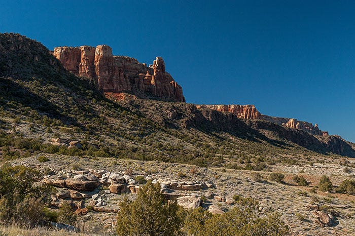
Here, we are looking up at the black Proterozoic basement rock, 1.7 billion years old, that underlies all of Colorado, and the fault along which it was pushed up. Above it, and 1.5 billion years younger, is the deep red Chinle formation. Above that is the primary feature of the Colorado National Monument, the Wingate formation. It’s a little light on top because that part got bleached over the eons by acid rain.
At point 3, the trail climbs up behind the fin along the Redlands Fault:
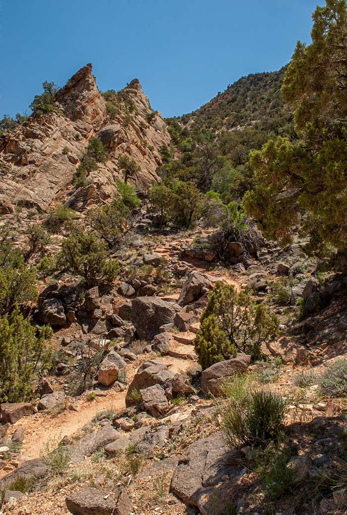
This is a geologically significant photo. On the left is a fin of Kayenta Formation rock, dragged upward when the ground on the right was forced upward. The bottom of this vee is the fault itself. The Kayenta Formation continues on the right side of the photo, about 1200 feet above. The hill in the background is the bench of Proterozoic basement rock that was mentioned in the previous photo.
The trail climbs up to the top of this fin, at Point 5 in the photo on the top of this post, at about 400 feet above the valley floor:
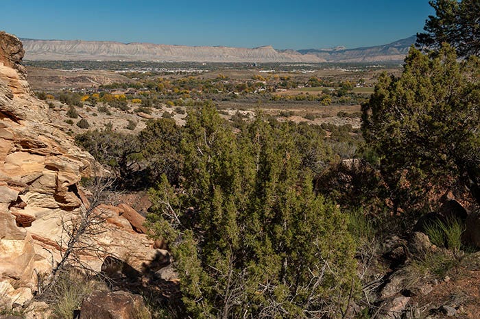
We’re looking northeast here, across the city of Grand Junction to Mt. Garfield and the Book Cliffs. It’s a nice view. The top of the “bench” is not much farther.
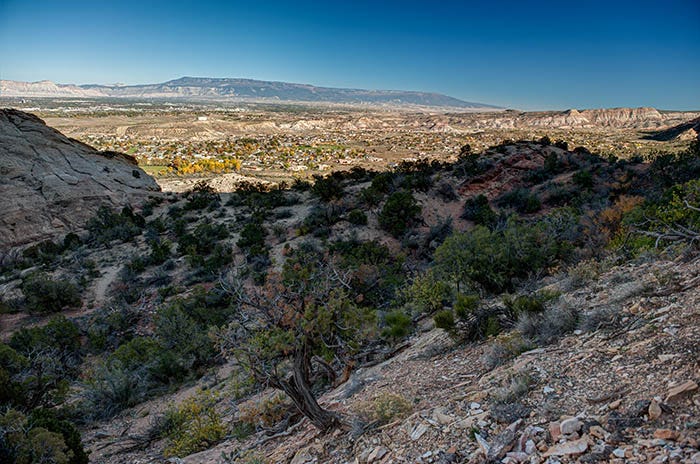
And here we are on the bench, at the edge. The fin of Kayenta rock is on the photo’s far left; you can see a little piece of the trail between it and the camera. The Grand Mesa (the largest flat-topped mountain in the world) is in the background. A few feet behind the camera, this trail crosses another trail that goes along the top of the bench, after which this trail proceeds up the face of the cliff.
Next: On the Cliffs: A Serious Case of The Willies