
Unaweep Canyon
The only one in the entire world

I have mentioned the Uncompahgre Uplift in a previous post:
The Piñon Mesa

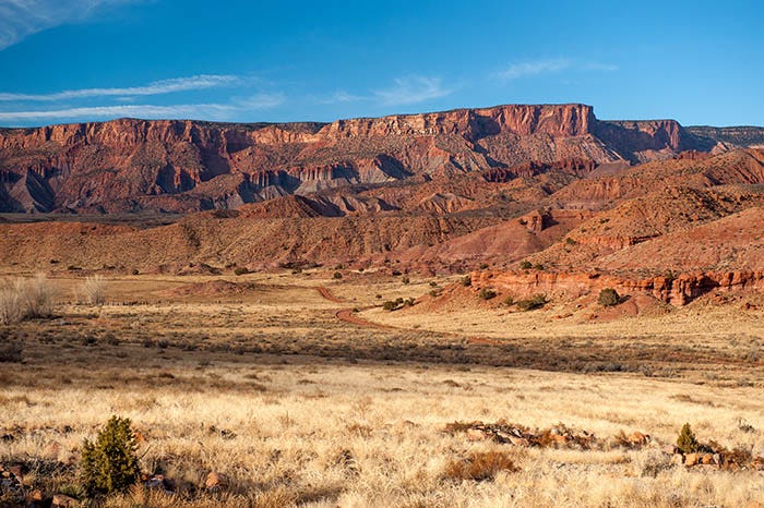
I have mentioned several times that the Colorado National Monument is at the edge of an uplift that occurred from 70 to 40 million years ago. That uplift, known as the Uncompahgre, is a cigar-shaped feature about 90 miles long that lies on a diagonal line with the northwest tip of it, called Piñon Mesa, at Grand Junction.
It’s a long, cigar-shaped anticline about ninety miles long that touches the Colorado-Utah state line. Not far from the northwest end is a canyon that cuts all the way through it! It’s the only canyon in the world that has two mouths. In fact, “Unaweep” is Ute for “canyon with two mouths.”
Unaweep Canyon is not far from Grand Junction. On a Christmas day some years ago, I ventured through it.
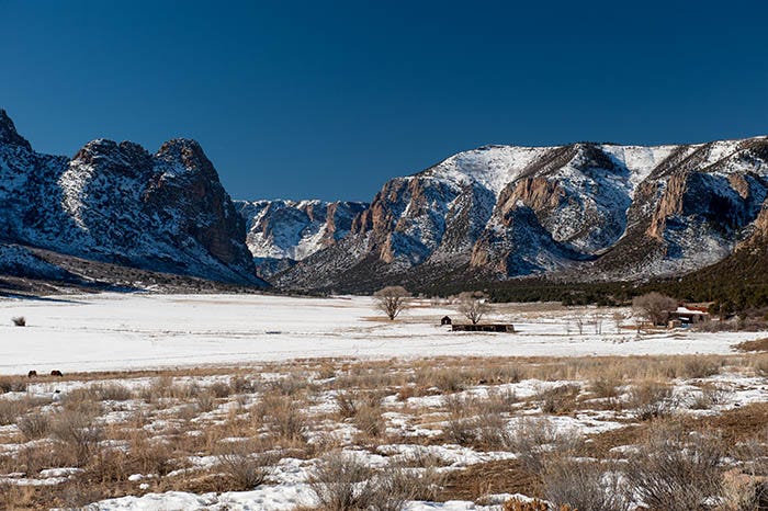
Geologists say that the canyon was cut by the Gunnison River and probably also the Colorado, before the land started uplifting 70 million years ago. At first, the rivers were able to keep up by eroding the canyon as the ground kept uplifting but eventually the uplift won and both rivers found a new course around the end of the uplift.
This shot (above) and the next one below were taken very near the canyon’s high point, from which two creeks flow out of it in opposite directions.
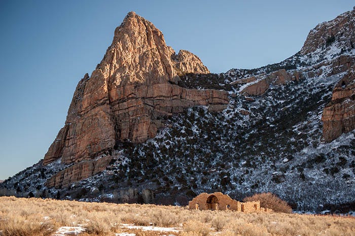
Up on top, to the north, is the Piñon Mesa, which I wrote about here. At the end of the canyon is the town of Gateway, on the Dolores River. A couple of miles further is the Utah state line. Here is what you see when you get to Gateway:
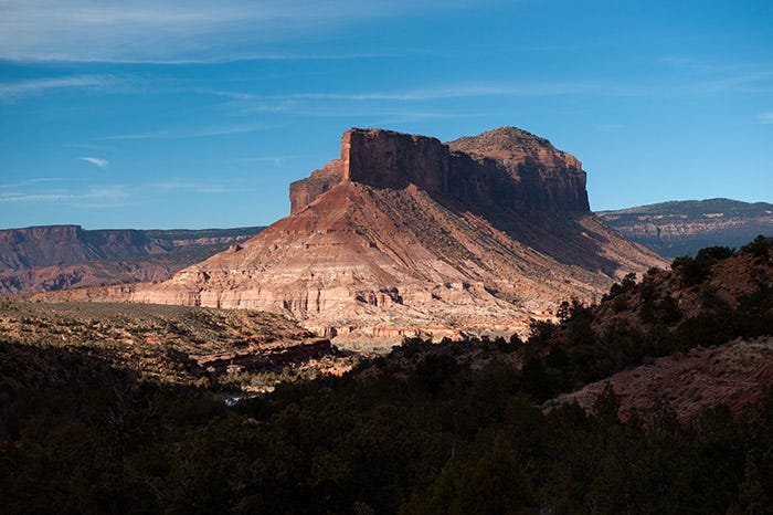
What we have here is a (mostly) sandstone remnant left behind from the erosion of the three rivers. There are nearly 150 million years’ worth of rock, spanning six geological formations, in this striking feature. I shall have a future post explaining them.
I spent the rest of the day driving around and photographing this thing. Here’s a view of it from the west, with the Dolores River in the foreground:
Makes you wanna just go up in those rocks and explore, doesn’t it? There is a road on the other side of the river. I went down it towards Utah:
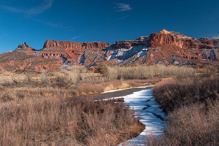
Here you can see the Cutler Formation quite well in the foreground, just across the road. Above it is the Moenkopi, and above that is the familiar blood-red Chinle Formation, which also has some gray rock in it. The top layer is the Wingate.
The Dolores River has cut a gouge into the side of the Uncompahgre Uplift here, exposing rock from the Permian to the Jurassic periods.
I found out years later that Butch Cassidy had ridden through here after one of his bank robberies. Apparently one of his partners in crime lived a little ways up the Dolores.
It was a good Christmas.
Each one of these photographs beckon me to visit, explore and stay for a long, long while. Expertly done!