

Wedding Canyon

John Otto was quite a colorful character. He lived with his horse and burros in tents and a cave in what is now the Colorado National Monument, eschewing the civilized life of four walls and heat. It was he who persuaded the US Government to preserve the place with National Monument status after President Taft visited the area in 1909.
At some point he met Beatrice Farnman, a Back-East artist who was a bit of a free spirit, and they married at the base of Independence Monument in what is now known as Wedding Canyon. The marriage only lasted a few weeks.
"I tried hard to live his way, but I could not do it," she wrote to a friend afterward. "I could not live with a man to whom even a cabin was an encumbrance."
Her next marriage, to a cowboy she met on a train, didn’t last much longer.
I told you all that to tell you about this: the hiking trail up Wedding Canyon in the Colorado National Monument that was almost certainly built by Otto himself.
The trail begins (and ends; it’s a loop) at the edge of a burg named Redlands just outside of Grand Junction. It ambles across the wasteland at the bottom edge of the Grand Valley toward the cliffs:
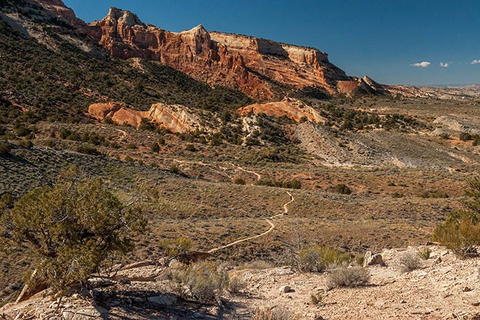
There is some interesting geology here. I have mentioned earlier that these cliffs are the result of an uplift from 70 to 40 million years ago. Here at the edge of the uplift, we see a lump of Entrada sandstone dead ahead that is also found at the top of the cliffs in the distance. Under that, and forming the slope on the left side of the photo, is the whitish Kayenta Formation which is about the same hardness as concrete.
Note that the Entrada rock is also forced into a tilt here at the edge of the uplift. To the right of it (originally above it) is a layer of the Wahnakum Formation. And above (to the right) of it is the mudstones of the Morrison Formation which covers most of this valley. It is in the Morrison that most dinosaur bones are found, and indeed there are dinosaur bones here, not far from the location of this photo.
The trail approaches the lump of Entrada rock…
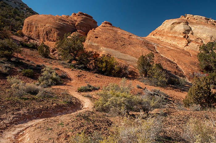
And goes up around the end of it. From there, the trail proceeds to the mouth of the canyon:
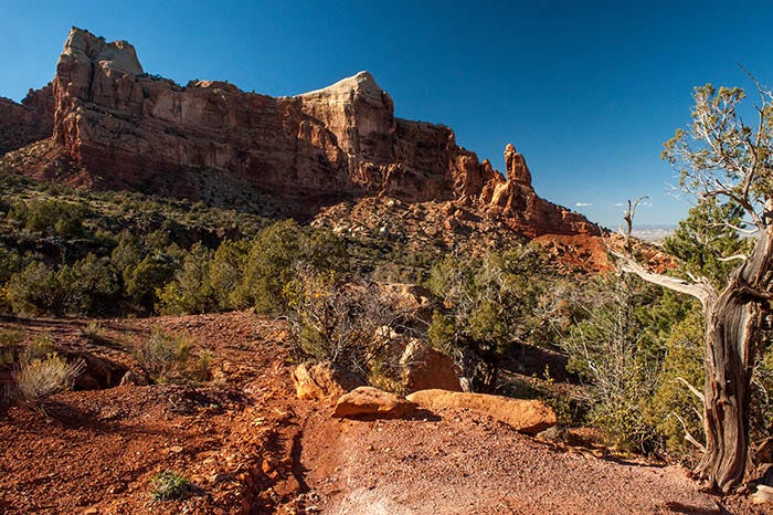
And begins a moderate climb up into the canyon.

It was here that I turned around. The sun was getting low. But the rest of the trail, looking at it from the cliffs above, looks like fairly easy going.