


A Big Road Trip
Day 5: The Black Canyon of the Gunnison (south rim)

The day had arrived for me to see, for the first time (that I remember1), that spooky place in my imagination named The Black Canyon of the Gunnison.
It is black because of geology, which I’ll explain below. And the “gun” part — well, that was an Army Captain, John Gunnison, that explored parts of Colorado and Utah in the mid-1800s. His second expedition to this untamed country passed through the area in 1853, where he was surveying a possible railroad route to the Great Salt Lake.
This will be a longer post than most. Here’s a preview, for the impatient, of what’s coming later in this post:
The Black Canyon is a 48-mile chasm in Colorado’s 1.7 billion-year-old basement rock that is, in some places, 2,000 feet deep. There are no bridges across it. So, you visit either the north rim or the south rim, not both. On this day, I would be visiting the south rim, where most of the National Park facilities are.
Spoiler alert: the most spectacular view, in my opinion, is from the other rim, which will be my next post.
The city of Gunnison is very near to the Gunnison River’s source. The Black Canyon is 63 miles downstream, on a road that is neither straight nor flat. It would have made more sense to have camped in Montrose, but I didn’t know that. I spent hours getting there.
A few miles short of Montrose, the road to the South Rim ascends a hill to the National Park entrance. At the pay booth is a road that branches to the right, and loses 2,000 feet of elevation (!) to get to a spot on the river. Do not take an RV down that road. Here is what’s at the bottom:
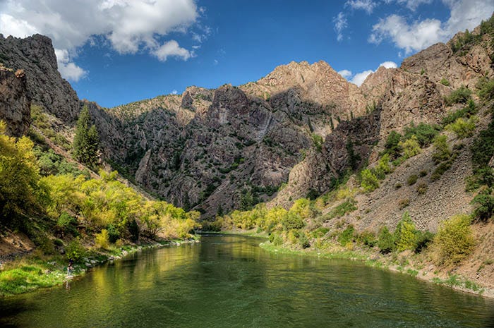
There is a campground down there with a picnic area. Since you can’t take an RV down that road (or ever hope to get it back up top again), it’s tent camping only. Since it was after Labor Day the place was empty:
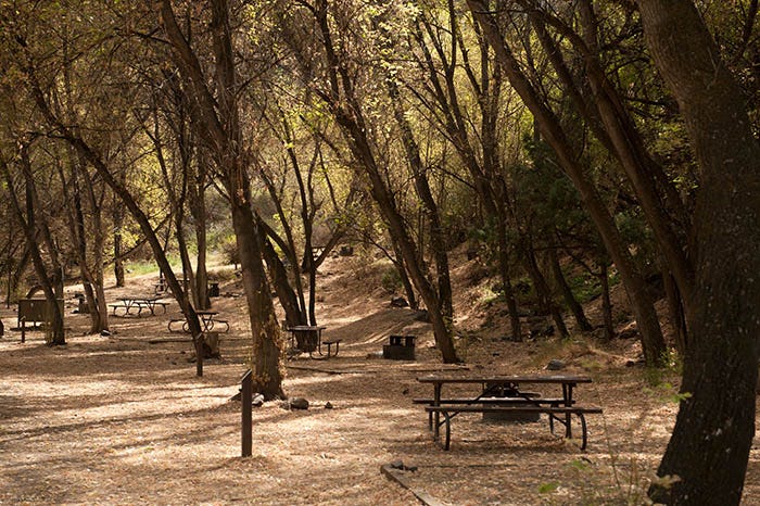
Not a bad place to camp. At least you have shade.
There is a fairly nice campground up on the south rim road. It accomodates RVs and some sites even have electricity. There are various viewpoints of the canyon along the South Rim road. Here’s one at a place called Tomichi Point:
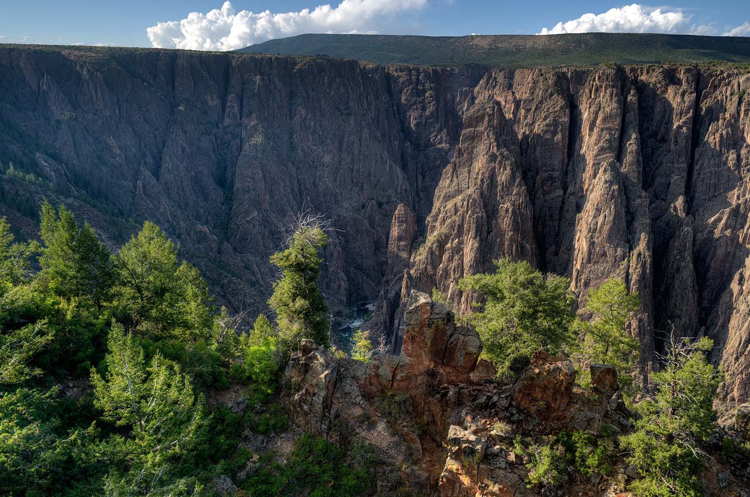
At this point, the walls of the canyon are not yet actually black. Eventually you come to the visitor center, with one heck of a viewpoint a short walk away.
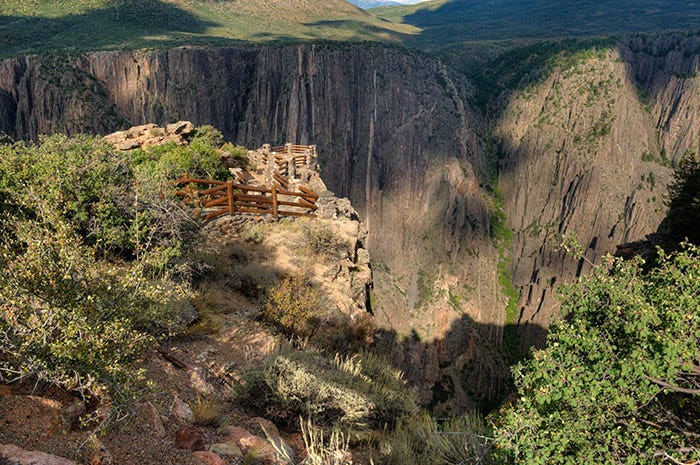
This is, in my opinion, the best viewpoint on the south rim. You can look down and see the river, some 1700 feet below you.
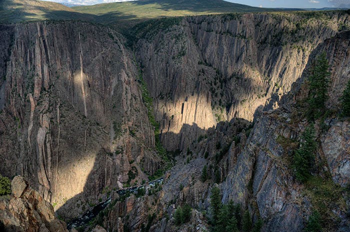
The Black Canyon is black because it was carved through Colorado’s “basement rock,” an ancient formation that is 1.7 billion years old and has been cooking next to Earth’s mantle for most of that time. It is black.
The Rocky Mountains were uplifted in the Laramide Orogeny some 70 to 40 million years ago. As the layers above this area eroded away, the lowest layer of rock became exposed on the surface. The Gunnison River already existed at that time, and as the land was lifted up, the river continued cutting its way down through this Proterozoic black rock.
About 1.4 billion years ago, fractures appeared in the black rock and pink stuff from underneath welled up and filled the fractures. Geologists call the pink rock Pegmatite and you can see veins of it in the canyon walls.
So that is why the Black Canyon is black. This black rock also appears at Grand Junction, at the bottom of the Colorado National Monument.
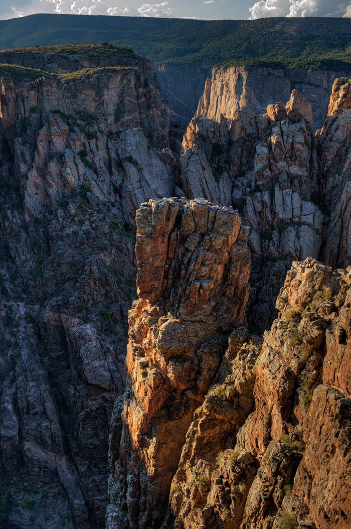
To me, the viewpoint at the visitor’s center was the best part of the south rim. I continued westward down the south rim road, following the river 1,700 feet below, as the sun also moved westward, starting to dip at an angle.
Note, if you will, the pink veins of pegmatite in the far wall.
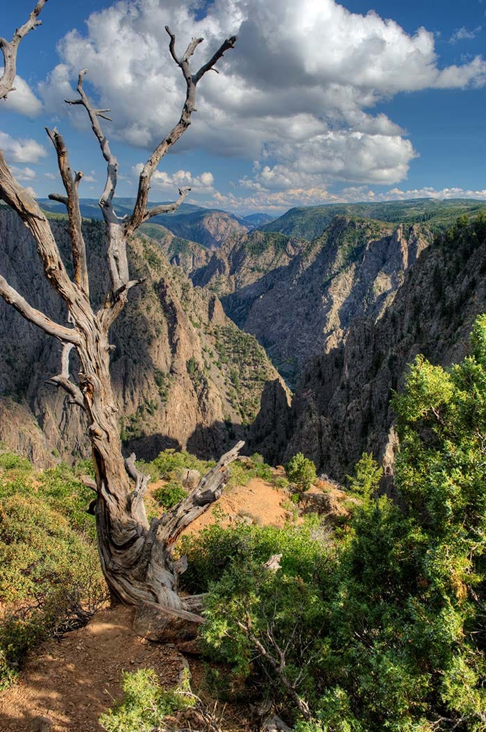
Finally, I came to the dead end of the South Rim road, at about sundown. There are no words to describe the view looking west down the river, towards the end of the canyon.

In the distance you can see a flat-topped mountain. That is the Grand Mesa, the largest flat-topped mountain in the world. Years later, I would find myself living on that mountain. But those are photos for another post.
I drove back to camp in Gunnison in the dark. It had been an exhilarating day.
And now, for the readers who have endured through this entire long post, a special treat. One of my readers recently posted that he “can’t get enough of those photospheres.” Well, here is one that I took at the viewpoint next to the visitor’s center. Be sure to use your mouse to look DOWN:
https://flickr.com/photos/beam-me-up/38580864440/in/datetaken-public/
As usual, you have to click on the link to see the photosphere. It takes a few minutes to start rendering. Be patient.
to be continued…
I don’t know whether I was there with them. I might not have been born yet.