
Hell's Backbone
An exposure of Navajo Formation sandstone

Hell’s Backbone is on the south side of Boulder Mountain, west of the town of Boulder, Utah. County Road 153 provides a loop road of sorts through it, with both ends of the latter coming out at different points on Utah state route 12.
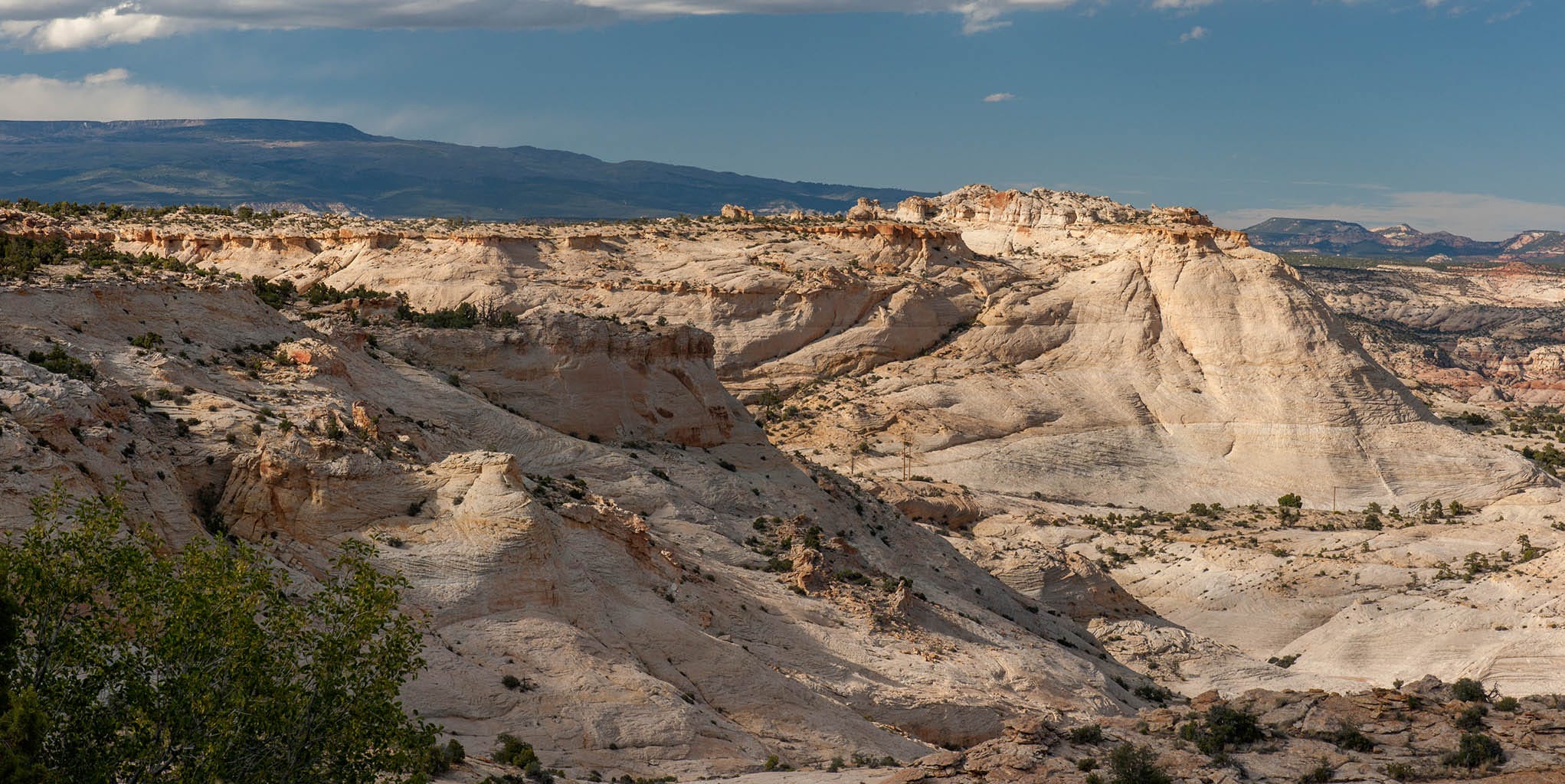
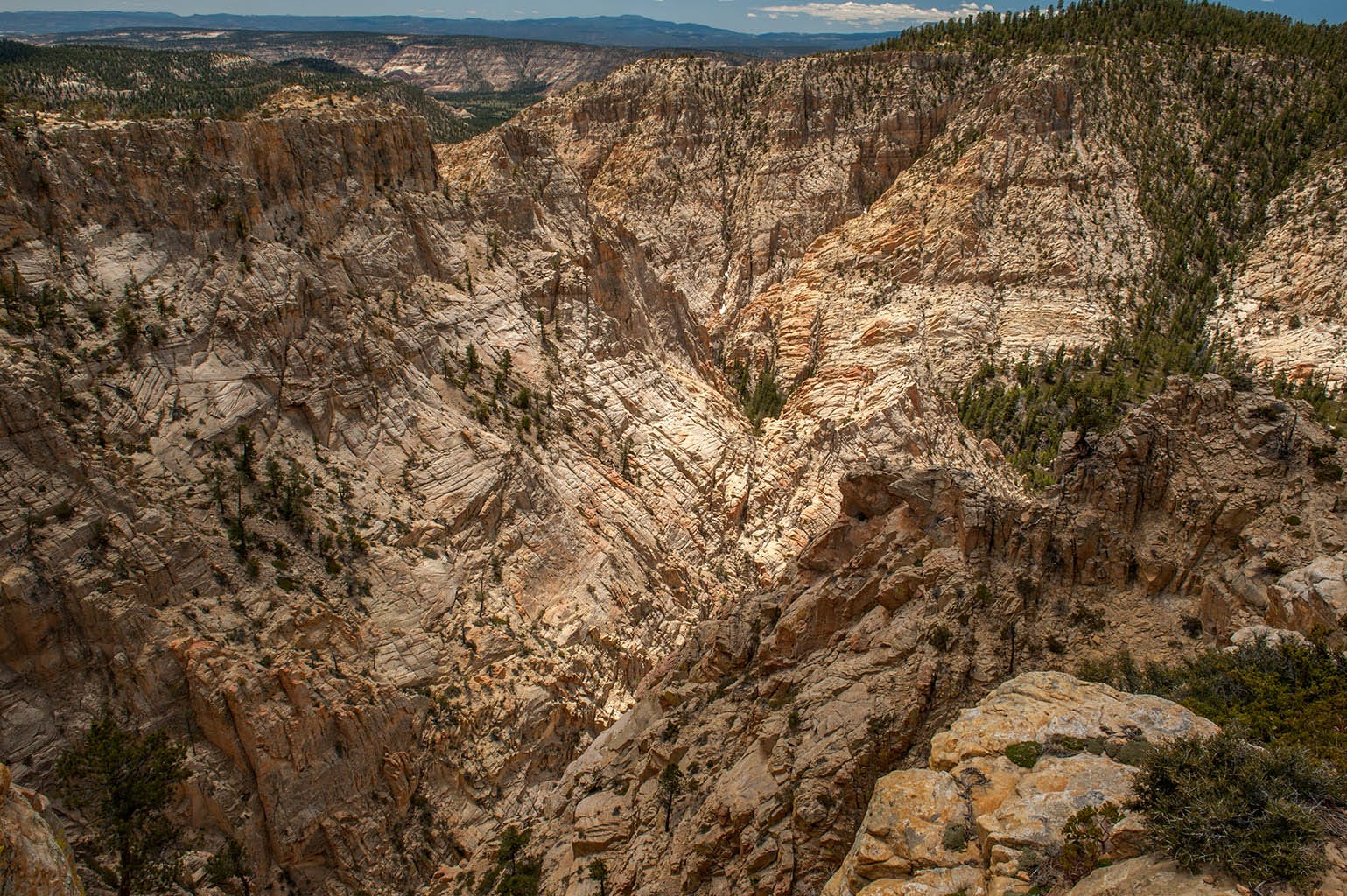
The Navajo Formation was laid down in the early Jurassic, just short of 200 million years ago, and is mostly white with touches of pink here and there. This part of Utah was a large interior seaway at the time as Pangaea was starting to break up, and this formation is mostly beach sand that solidified into rock. The age of the dinosaurs had just begun, but since this location was under water there were no dinosaurs here. Here is an outcrop of the stuff:
Navajo sandstone is normally somewhat smooth with ripples in it, but at Hell’s Backbone it has eroded into a jagged, impossible-to-negotiate Hellscape that evokes horror as you look at it. For some reason, the Civilian Conservation Corps, a Depression-era jobs program, decided to build a road through it that Wikipedia describes as “easily passable by ordinary passenger vehicles, but … very narrow and winding, and not for the faint of heart.”
That might be an understatement.
Here is the first view you get of the place when traveling west (from Boulder to Escalante) on the road:
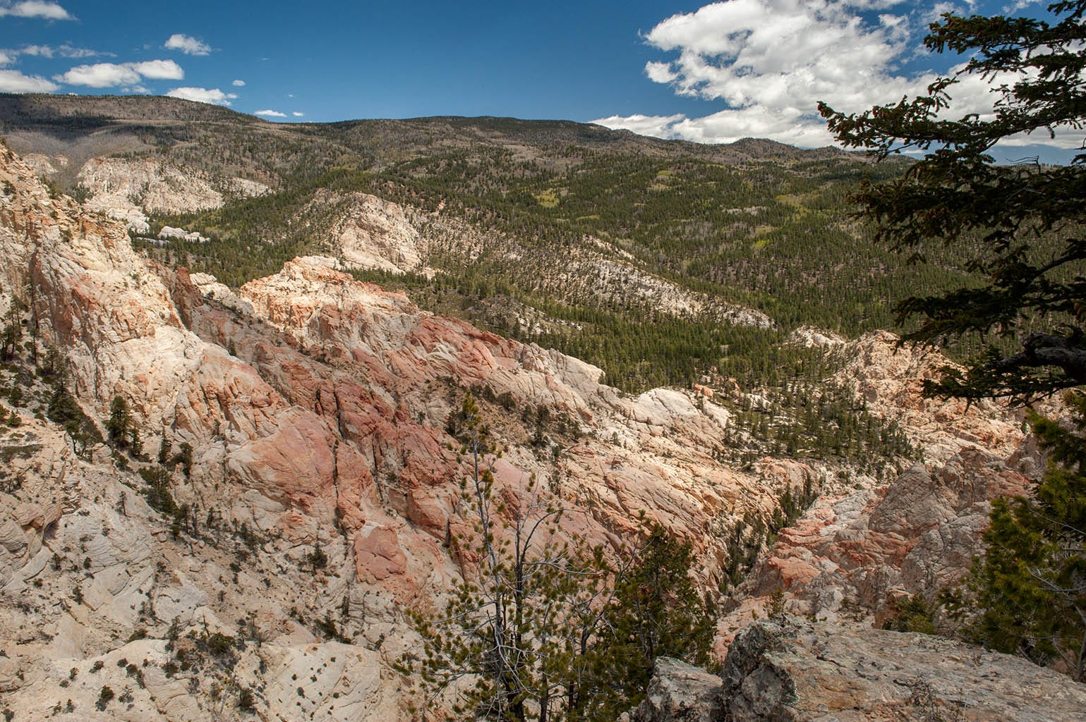
Soon, you come to Death Hollow, which in my opinion is the most spectacular part of the trip:
You can click any of these photos to zoom in a little bit. Somewhere, there is a hiking trail through all of that. I don’t think I would care to hike it.
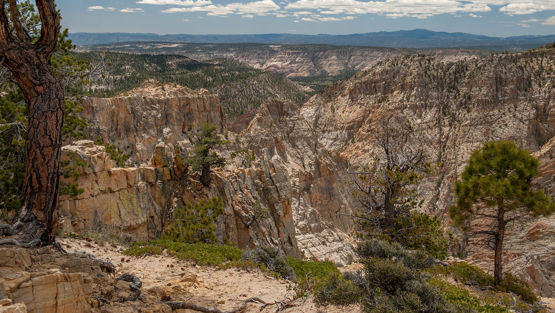
Another view of Death Hollow:
Not far past this viewpoint is a bridge with one heck of a story. It’s frightening enough to cross it, but the story of how they built it — uff da. They felled a couple of big trees across the abyss, then drove a bulldozer across the logs, with a rope around the chest of the man driving the dozer, in case the dozer fell down off of the logs. As if that would save him! Not for me, man.
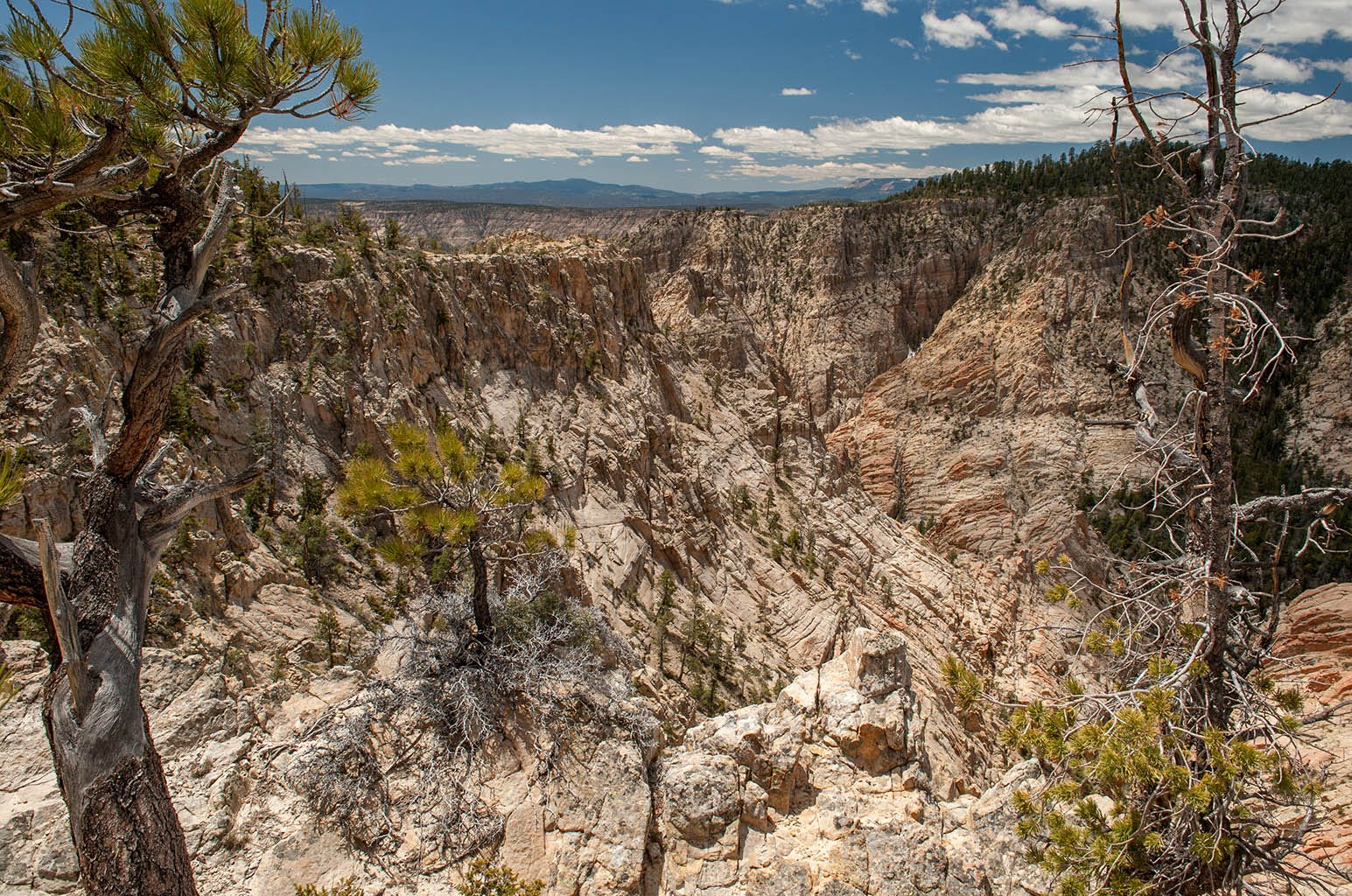
Here is yet another view of the place, also looking down into Death Hollow.
The (in)famous bridge is just past this viewpoint.
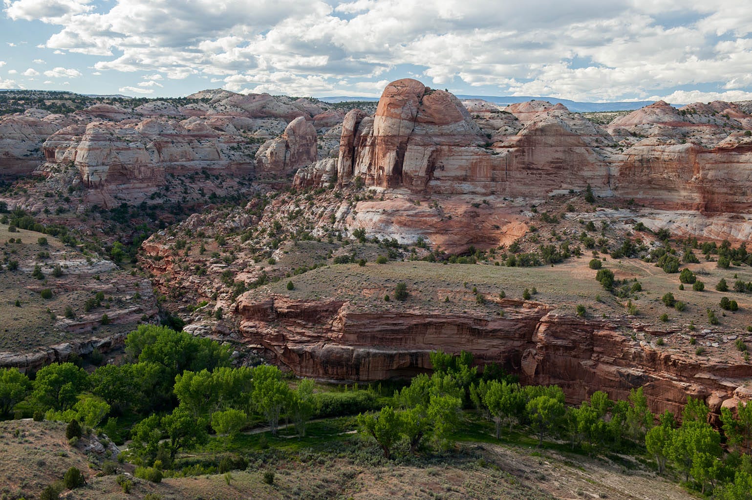
On the way home, driving from Escalante back to camp on State Highway 12, I caught this delicious1 view of the Escalante River:
Paid subscribers received a large, full-rez copy of this image about a week ago.
It was a good day for photography.
"Delicious” because it looks like a gigantic strawberry sundae!
Wow desolate yet you captured so much beauty!