


The Deadliest 4WD Road in Colorado
aka The Elk Mountains, part 2

My previous post’s saga ended halfway through the day at the edge of Paradise Basin, above Crested Butte Colorado. Today’s adventure story goes from there down the Crystal River.
Immediately below Paradise Basin, containing a creek that feeds the Crystal River, is a place called Elko Park:
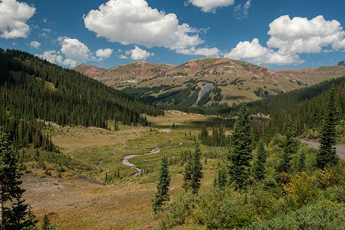
Note the three red hills in the distance. The edge of the Maroon Bells - Snowmass Wilderness runs along the tops of them. The Maroon Bells themselves are the next ridge behind these hills.
The road descends down into Elko Park:
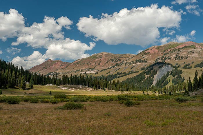
Note the same three hills. At the gray rockslide is a hiking / backpacking trail that goes into the wilderness and comes out at that famous spot, near the town of Aspen, where you see Colorado’s Maroon Bells mountains. Here is the view down the Crystal River from that trailhead:
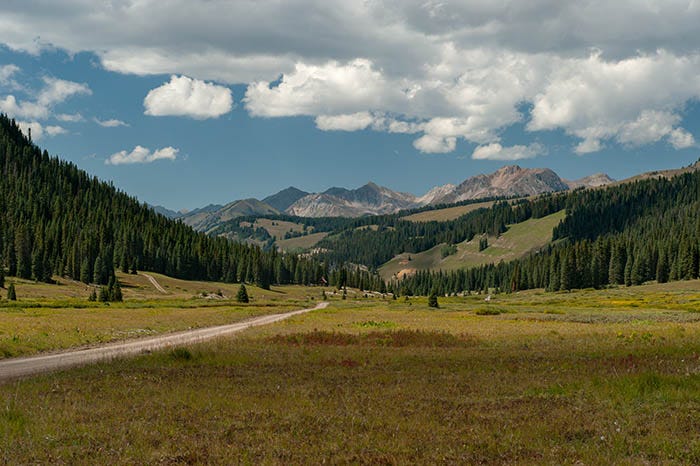
The wild and rugged mountains in the distance are near Snowmass Mountain, and are in the Maroon Bells - Snowmass Wilderness.
A little way down the road is a pretty waterfall:
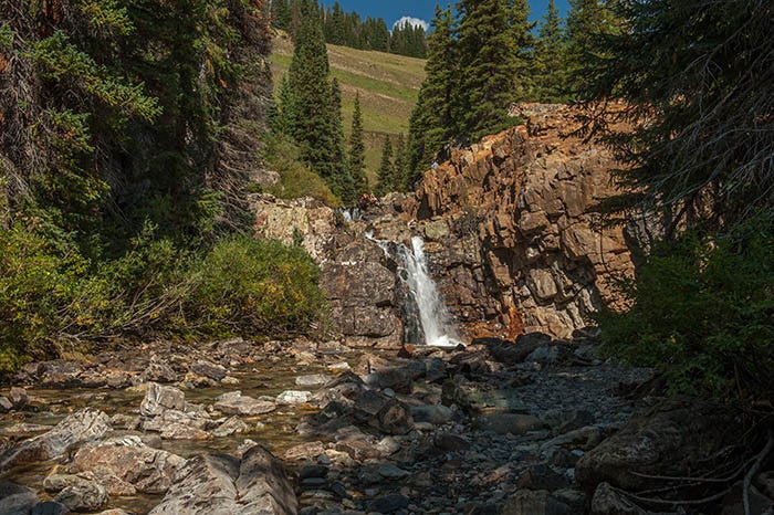
It is here that the nice, smooth gravel Forest Service road ends and people are advised to turn around.
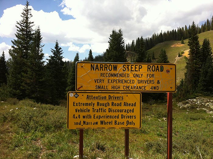
Seventeen people have lost their lives over the years on the next stretch of this road behind this sign.
Here’s your last view of a nice, sweet little creek…
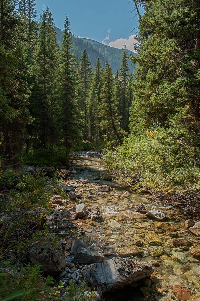
…before it all turns into Hell:
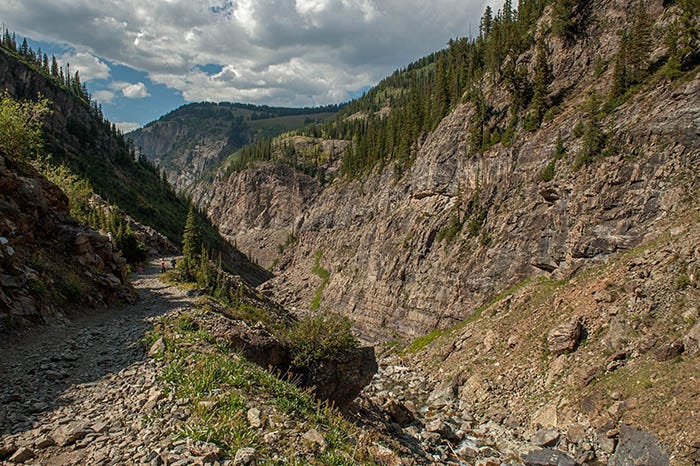
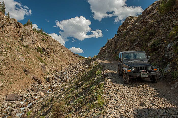
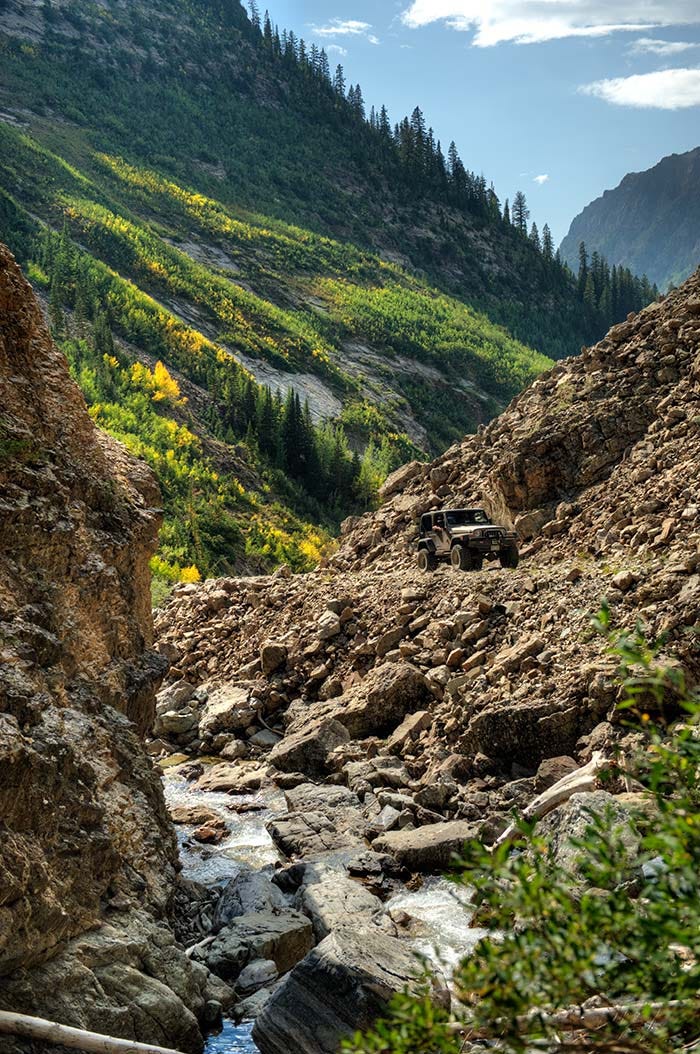
When you start down this stretch of road, there are no turnouts, and no turning around. If you meet someone coming the other way, one of you will have to back up — maybe as much as a mile. No one was coming the other way that day. Here’s a picture of my Jeep near the bottom:
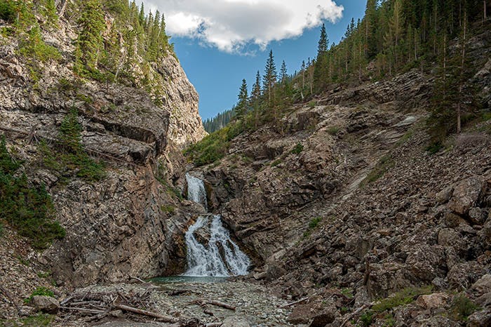
For the life of me, I cannot understand why I did not photograph the large boulder in this road that was right behind me. It forces the driver to skirt around it, dangerously close to the edge. There is a waterfall there, and a steep drop-off right there where you have to go around the boulder. Here’s the waterfall.
The shelf road is in the upper right corner of this photo, and the boulder is up there just out of sight. Both fatal accidents were in large SUVs the size of a Chevy Suburban, and were packed with people. In both cases, a wheel dropped off of the edge of the road into this spot, causing the vehicles to roll and passengers to be thrown out of it. One of the bodies was never found.
After getting around the boulder and across the scary bridge below it, I parked and took a few photos, including this one (above) of the falls. There were lots of people around who had come upstream from the towns below, but none attempted the dangerous spot in the road: they parked here and either hiked up the road, or just hung out at the waterfall.
When I wrote to my mother, now deceased, of this little adventure, she emailed me back with “DON’T EVER DO THAT AGAIN!”
I have no intention of ever doing this road again. It is definitely scary.
Here’s a view looking downcanyon while standing on the scary bridge that crosses the Crystal River just below Devil’s Punchbowl falls:
I didn’t photograph it, but there was another Jeep® in the bottom of this canyon, upside down and rusting. Somebody didn’t make it.
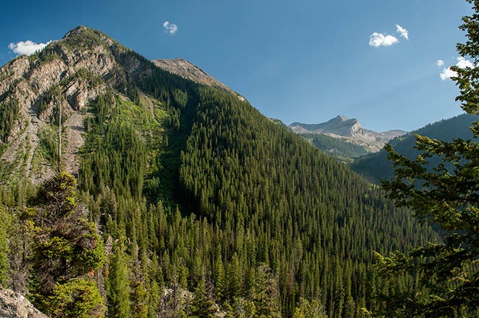
Remember a photo in the previous post here that had Treasury Mountain in it? Well, here we see it again. We’re almost on the other side of it here, and it looks strange on this side:
A few more miles downriver is the “ghost town” (like St. Elmo and Tincup, there are some lively ghosts there) of Crystal. Just above Crystal is a straight stretch of road through some aspens that is just beautiful:

Life just doesn’t get any better than this. Moments like this are why I drive a Jeep®.
At the town of Crystal is supposedly the “most photographed scene in Colorado,” the powerhouse for the Crystal mill:
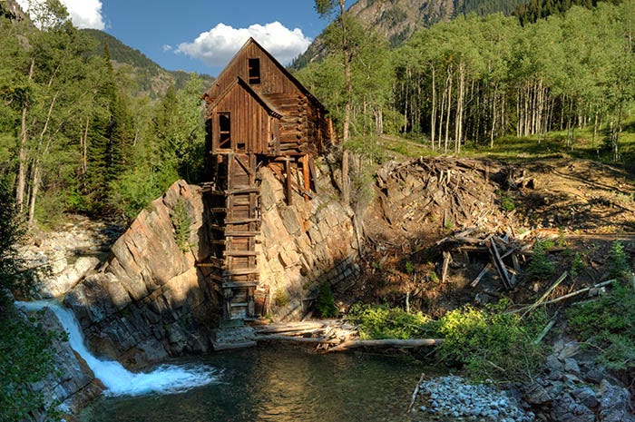
This scene is in many, many Colorado calendars and other scenic collections, but I doubt that it is the “most photographed" in all of Colorado. For one thing, four wheel drive is required to get up here from the next town (a real town,by the way) downriver.
Also, this building was not the mill! That pile of rubble to the right of this building was the mill. This was the powerhouse, which had a drive shaft going down through that wooden thing that hangs down, and a horizontal water wheel at the bottom. In the building were air compressors that supplied power not only to the mill, but to several area mines. If I remember correctly, they mostly mined silver here.
But it is scenic, and it is famous. Paid subscribers to this Substack received a large, hi-res, suitable-for-printing-and-framing copy of this photo a couple of months ago.
I hung around, taking more photos as the sun went down and the shadows crept up the riverbank. Daylight was ending. It was time to move on.
Just downriver, and about where the 4WD road becomes a decent road again, is the town of Marble. They quarry marble there, some of the purest marble available in the United States. Several buildings in Washington, DC are built from marble quarried there.
Here is Whitehouse Mountain, which is mostly marble, as seen from the road:
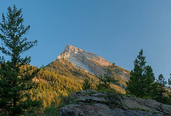
According to the maps, the marble quarry is on the other side of this mountain. I didn’t go there.
It was getting late, and I was nearly a hundred miles from camp. I headed back, in the dark, over Kebler Pass. A disappointment, because I really wanted to see Kebler Pass. At least I didn’t run over any elves in the dark.